Cycling the Ororon Line in Hokkaido
A Scenic Road Guide with Views of Mt. Rishiri
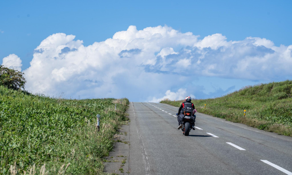
The Ororon Line is a breathtaking coastal route in northern Hokkaido along the Sea of Japan. Stretching all the way from Otaru to Wakkanai, its highlight lies in Route 106 between Teshio and Wakkanai. To the left, Mt. Rishiri rises majestically from the sea; to the right, the vast Sarobetsu Plain extends endlessly. With few sharp bends, the road runs straight toward the horizon, offering an exhilarating ride. This time, we’ll take on that very core section by bicycle.
Text&Photo_Hokokara
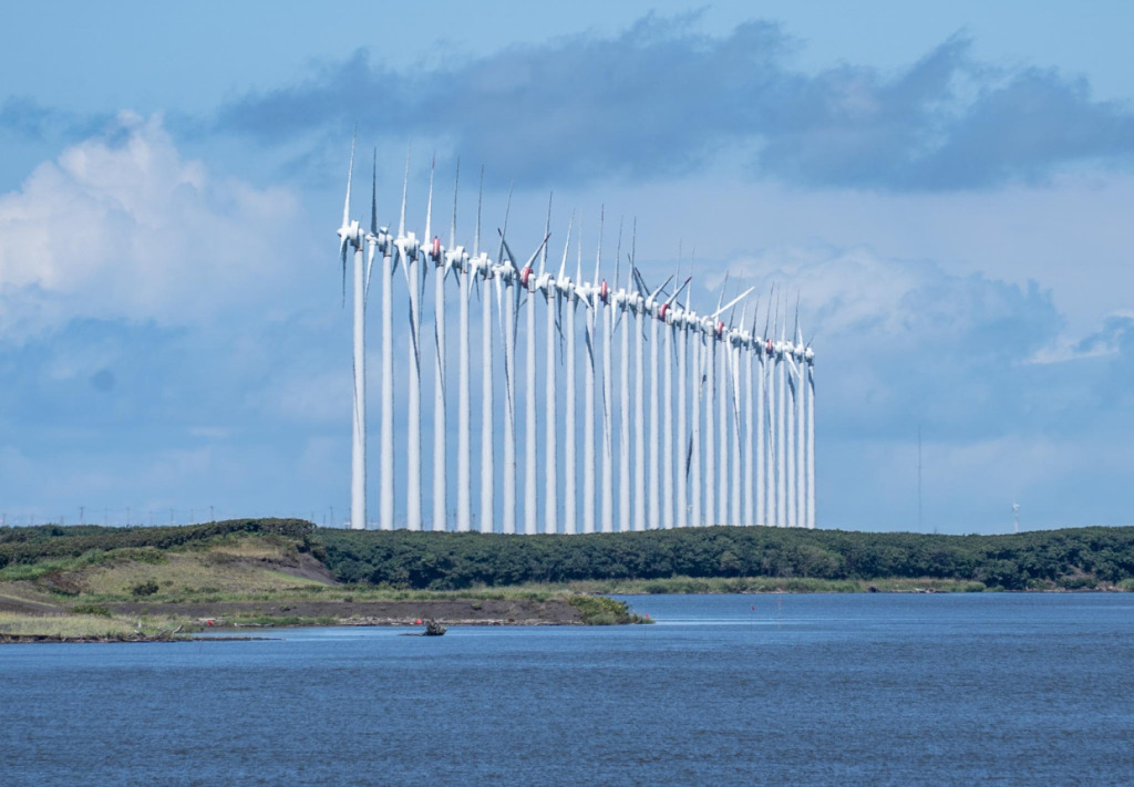
Table of Contents
1. Horonobe Station on the Sōya Main Line, reached from JR Asahikawa Station
2. The starting point of the cycling route: Teshio Town
3. The Monument of the 45th Parallel North
4. Parking shelters that reveal life in snowy country
5. Cape Noshappu, a northern cape town
6. Wakkanai, the final destination of the Ororon Line
1. Horonobe Station on the Sōya Main Line, reached from JR Asahikawa Station
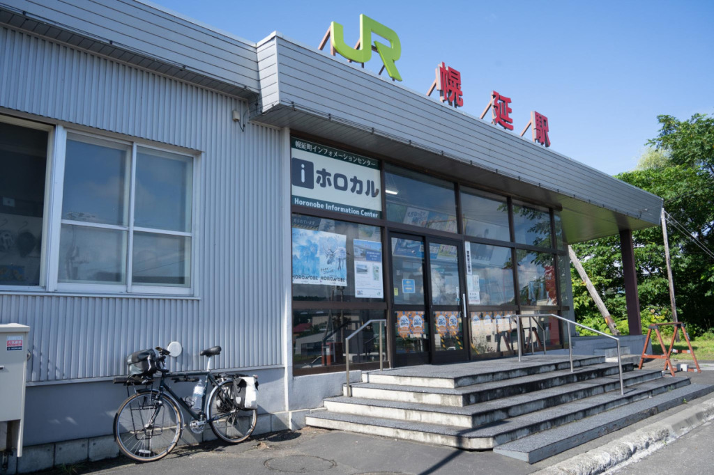
This journey takes place in northern Hokkaido, in the Dōhoku area. The starting point is JR Horonobe Station, located in Horonobe Town, near the northern tip of Japan. The station sits on the Sōya Main Line, offering direct access from Asahikawa Station. While the ride takes time, it involves few transfers, making travel from Tokyo or Sapporo surprisingly straightforward. Alternatively, you can fly into Wakkanai Airport and reach Horonobe via Wakkanai Station.

First, stop for breakfast at Seicomart Horonobe, the nearest store to Horonobe Station. From here, it’s about 20 km to Teshio, where you’ll join the Ororon Line, but since there are no shops along the way, it’s best to eat here before setting off.
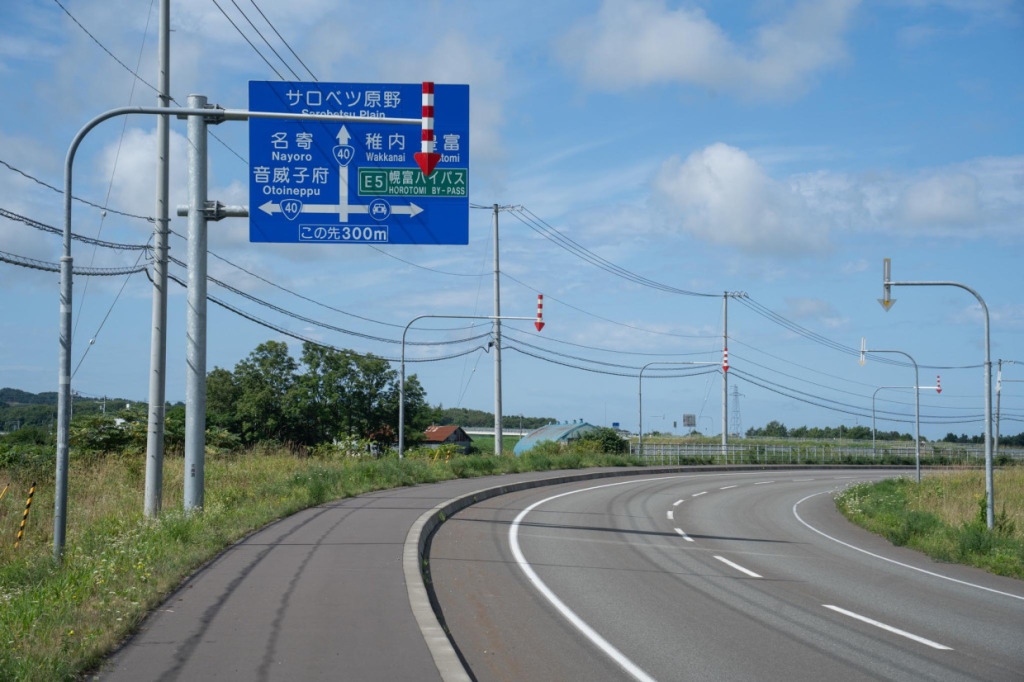
I thought of the 20 km to Teshio Town as just a warm-up before the real ride on the Ororon Line, but the vast Hokkaido scenery along the way already lifts my spirits.
2. The starting point of the cycling route: Teshio Town
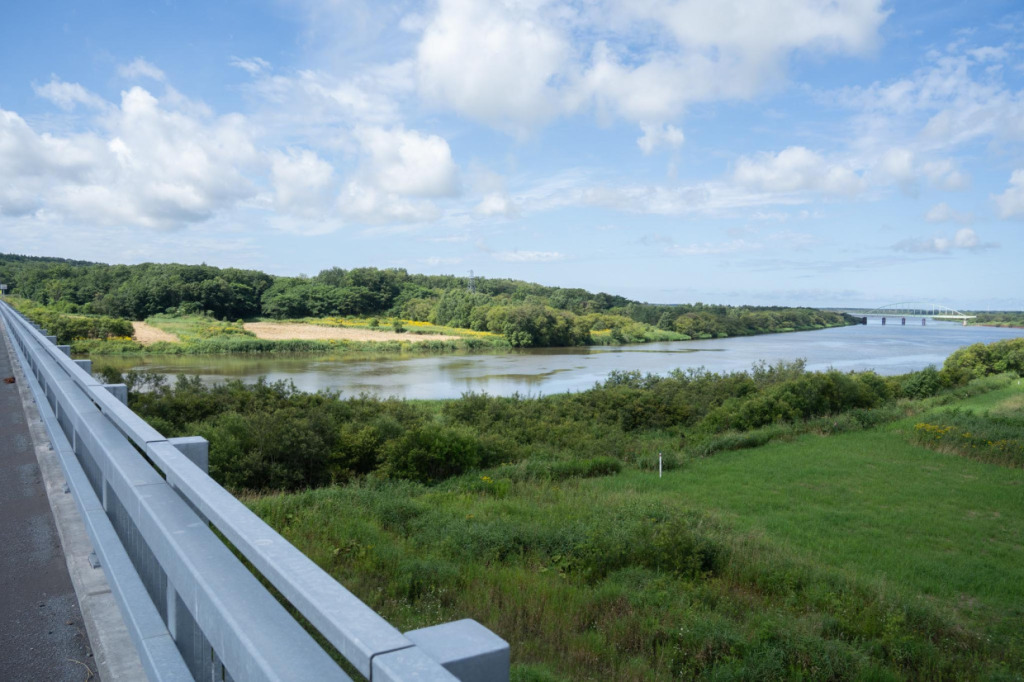
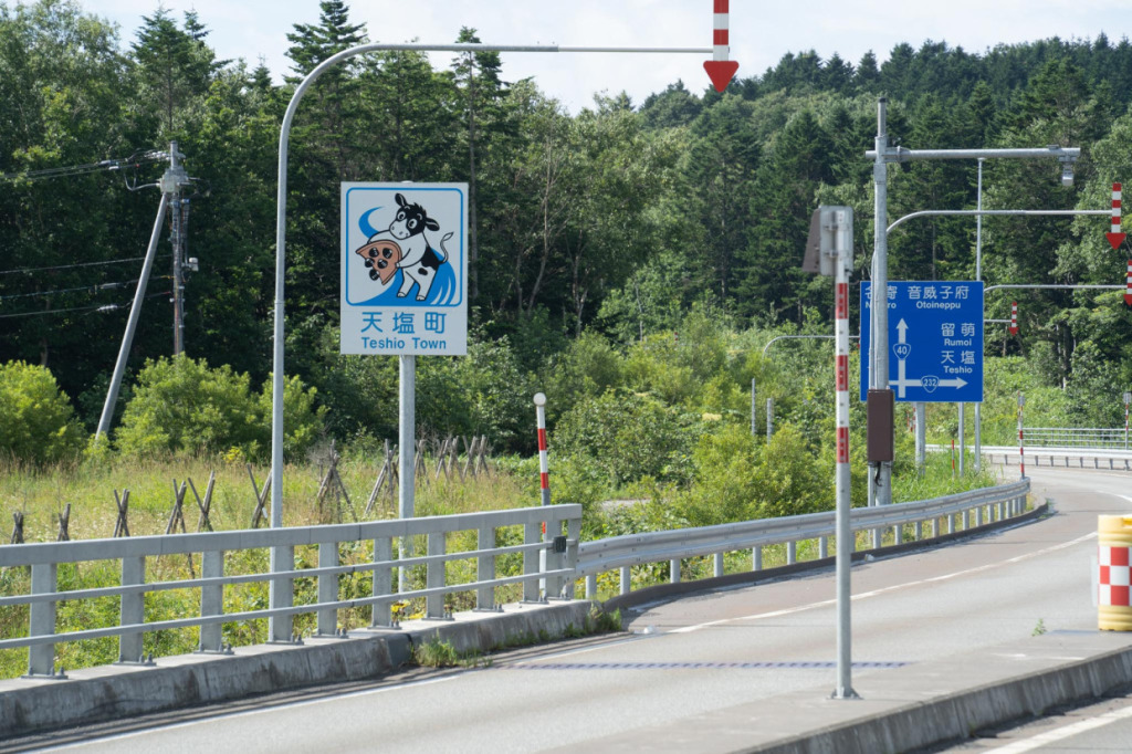
After cycling about 5 km from Horonobe Station and crossing the Teshio Bridge, you enter Teshio Town. The town’s name is said to be derived from the Ainu word teshu, which includes the meaning of a yana—a traditional fish trap made by placing wood, bamboo, or stakes in the water to obstruct the flow and catch fish (excerpt from the Teshio Town website).
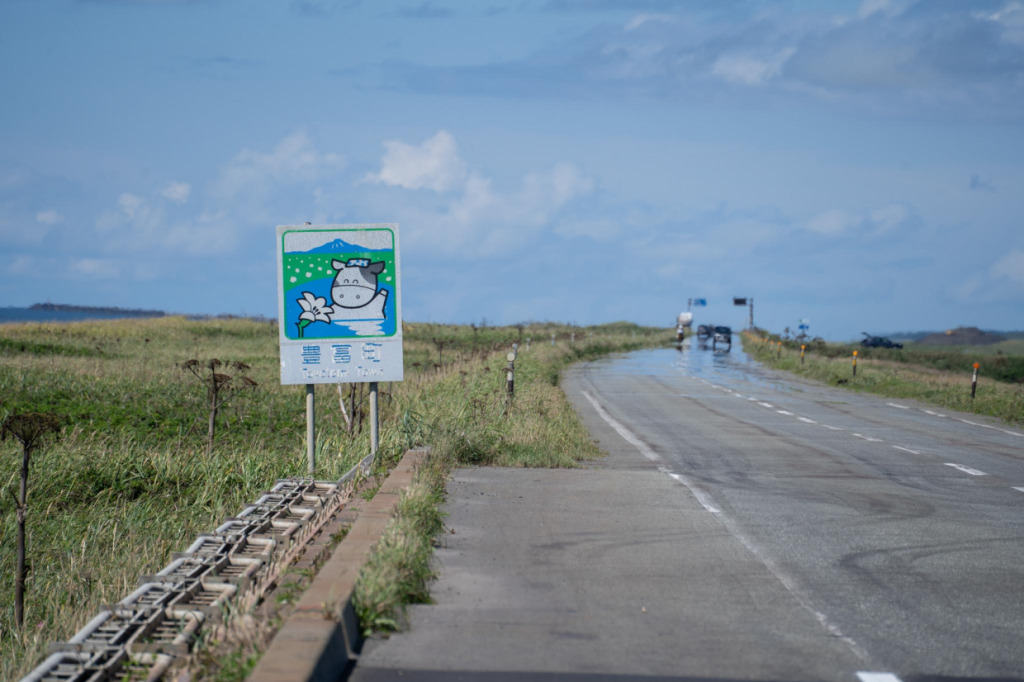
Greeting you just past the bridge is a unique roadside sign showing a cow scooping up a giant shijimi clam. Teshio Town is known for both shijimi clam fishing and dairy farming. The Teshio River, the second longest river in Hokkaido, has long supported clam fishing with its abundant waters. For reference, the longest river in Hokkaido is the Ishikari River.
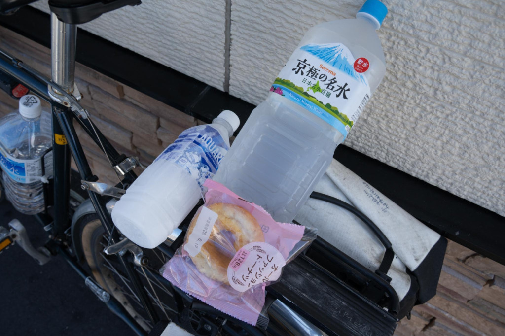
Arriving at Seicomart Teshio Kawaguchi marks the entry into the town center. Here, you can restock on food in preparation for the main stretch of the Ororon Line. You might feel, “Another Seicomart?”—but for the next 60 km or so, there are no restaurants or convenience stores along the way. Make sure to have plenty of drinks and snacks to avoid running out of energy.

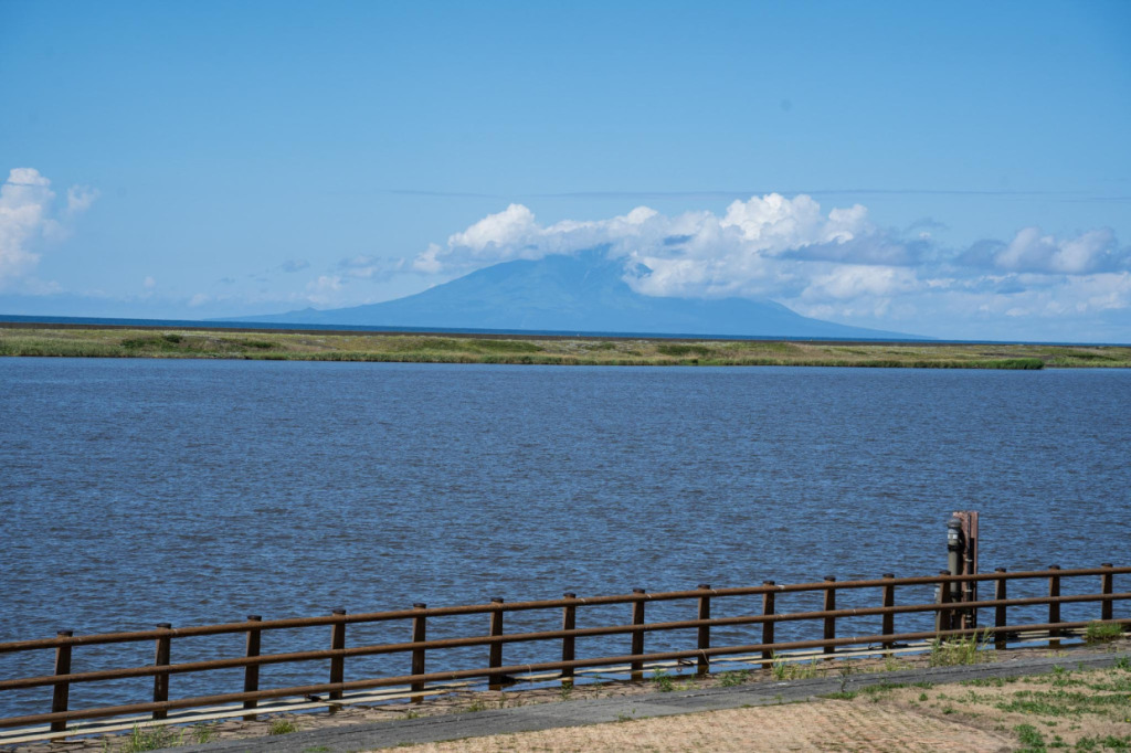
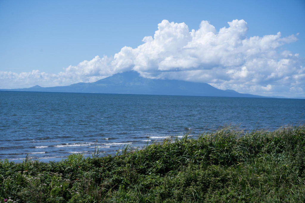
To the northwest rises Mt. Rishiri on Rishiri Island, a famous peak selected as one of Japan’s 100 notable mountains. In summer, clouds often cover the summit as the day progresses, making it a bit challenging to see the entire mountain. That’s why catching a glimpse of it in the morning, for example, is especially breathtaking.
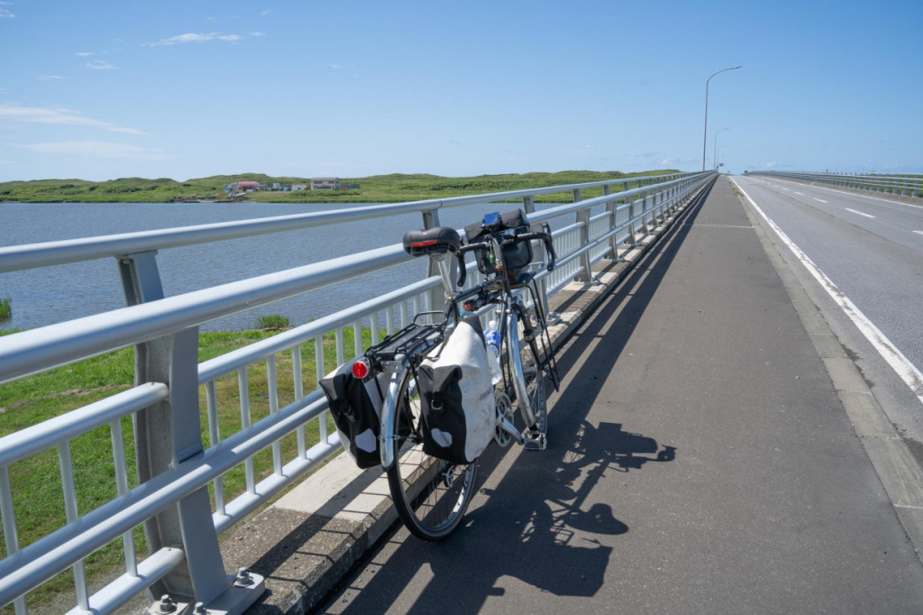
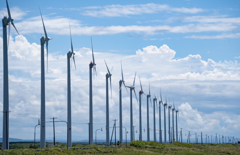
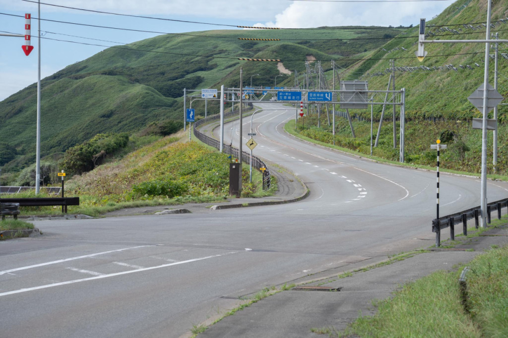
Crossing the Teshio-Kōkō Bridge brings you to the heart of the Ororon Line. The vast, endless Sarobetsu Plain stretches out before you, and the towering Otonrui wind turbines lined up in a straight row welcome you to the start of this spectacular cycling route.
One of the features that makes the Ororon Line scenery so striking is the perfectly aligned Otonrui wind turbines. They were originally scheduled to cease operation at the end of March 2023 for replacement, but the schedule was changed, and they will now continue running until March 2027. In other words, this is a view you can only experience now. While they still stand, this is the perfect route to ride and truly feel their presence.
3. The Monument of the 45th Parallel North
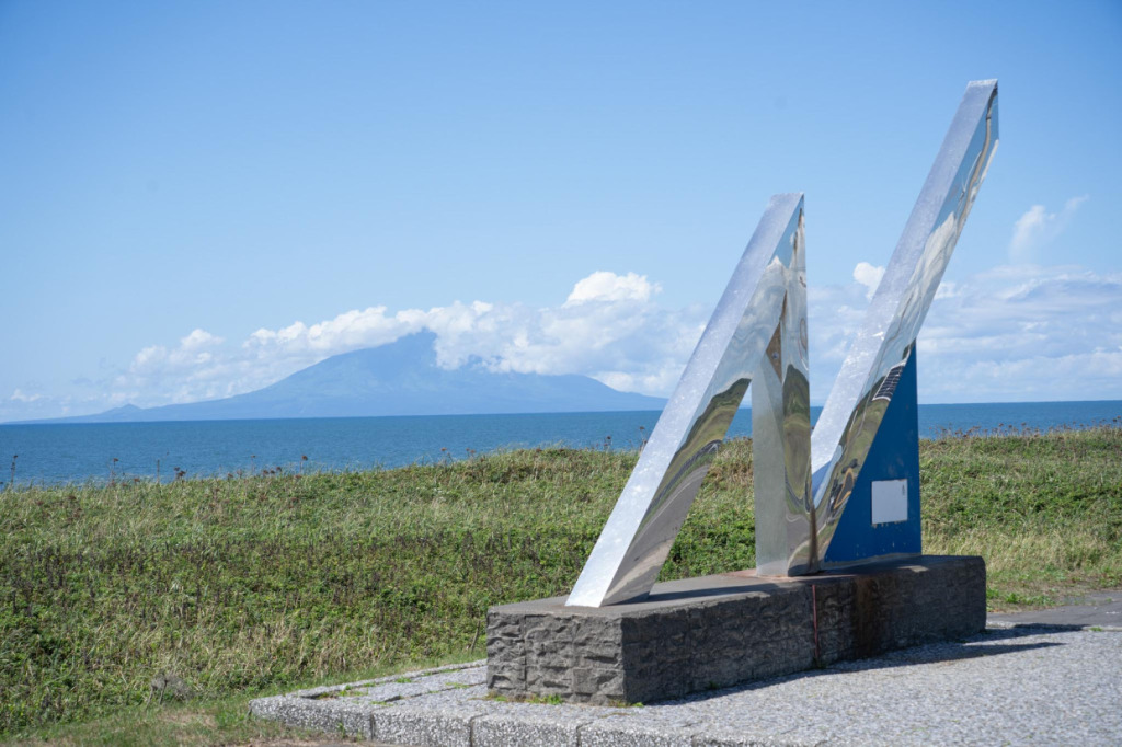
Heading north along the Ororon Line, you’ll come across the striking 45th Parallel North Monument, recognizable by its tilted “N” shape. The 45th parallel north lies roughly halfway between the Equator and the North Pole, and along this line, you can find regions around the world such as Bordeaux in France, northern Italy, Mongolia, China’s Heilongjiang Province, and areas from Oregon to Michigan in the United States.
At this latitude, summer days are long, with the sun setting late, while winter days are short—the seasonal contrast is especially pronounced. Being from Miyazaki, I already feel that winter is harsh around the Shinshu region, but areas beyond the 45th parallel north are recognized worldwide as places where winter truly bites.
The 45th Parallel North Monument feels almost like a gateway to the “true northern land.”
4. Parking shelters that reveal life in snowy country
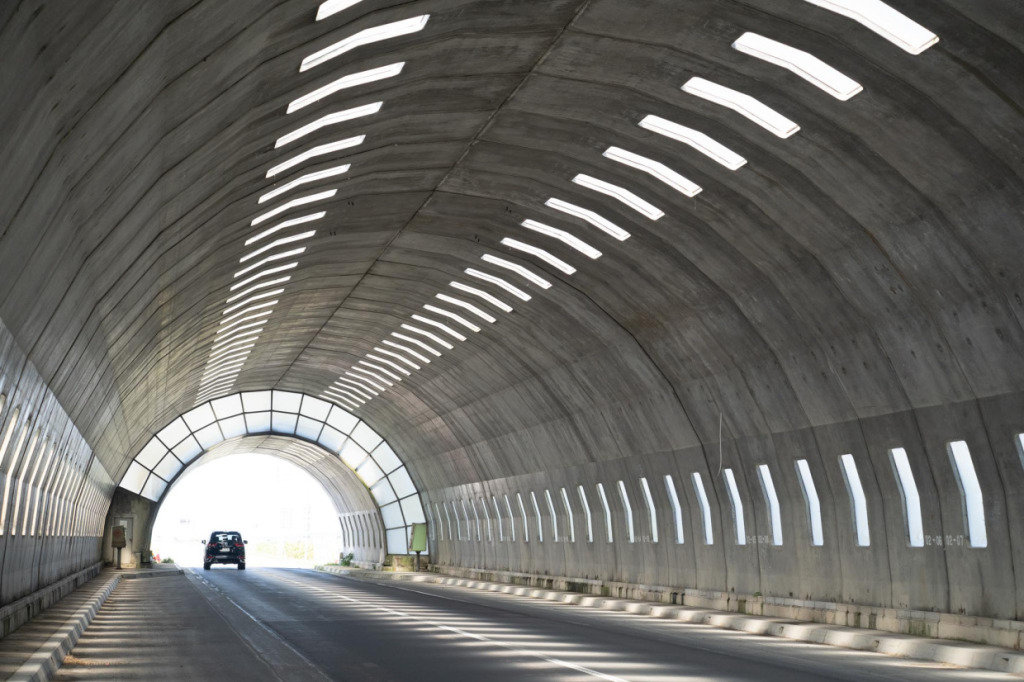
The next point of interest is located just near the 45th Parallel North Monument: the Hamarisato Parking Shelter, which at first glance looks like a tunnel.
This is a facility unique to snowy regions, especially in the Sarobetsu Plain, where it was built to provide refuge for vehicles during winter blizzards. While snowfall in this area isn’t particularly heavy, the strong winds sweeping across the vast, unobstructed plain can lift snow into the air, creating “ground blizzards” that can obscure visibility even on clear days. The parking shelter serves as a safe place for drivers to pull over and wait for the weather to improve without taking risks.
Visited in summer, it might appear as just a stark, utilitarian structure. Yet behind it lies the wisdom of people living in harmony with a harsh environment. Seeing this facility along the Ororon Line allows you to appreciate both the severity of nature and the ingenious measures developed to overcome it.
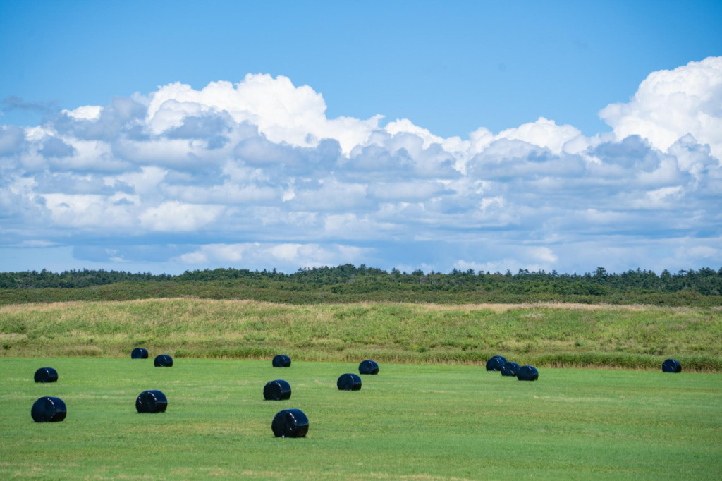
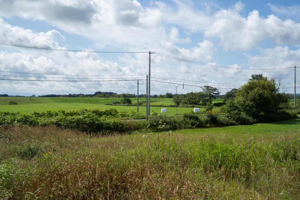
They are called “rolled bale silage,” a method of preserving grass. The harvested grass is rolled into cylinders and tightly wrapped in plastic film to ferment, creating high-quality silage for cattle feed. The black wrap absorbs sunlight to aid fermentation, allowing the silage to be reliably stored even through snowy winters.
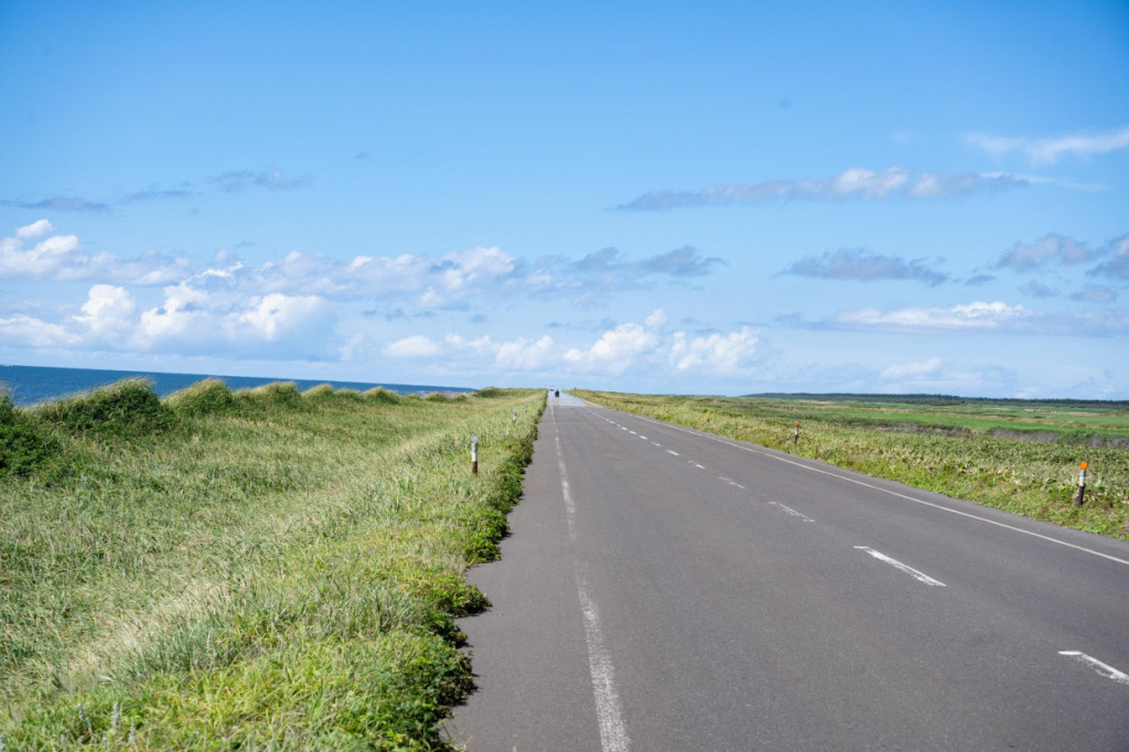
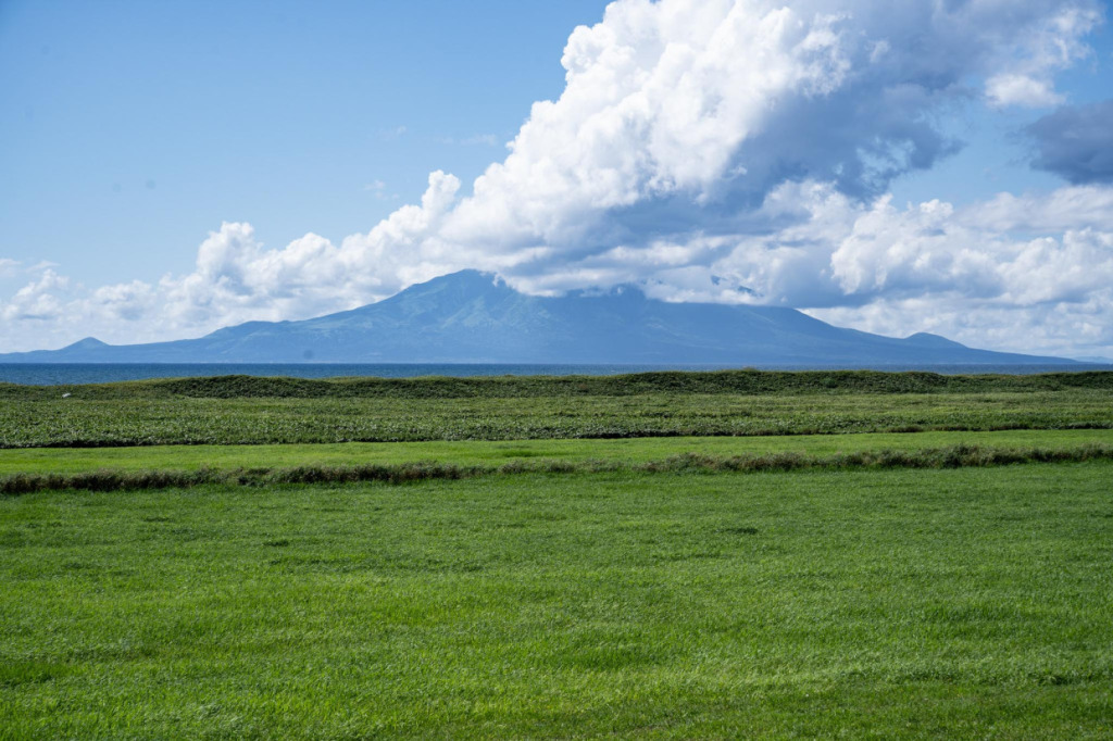
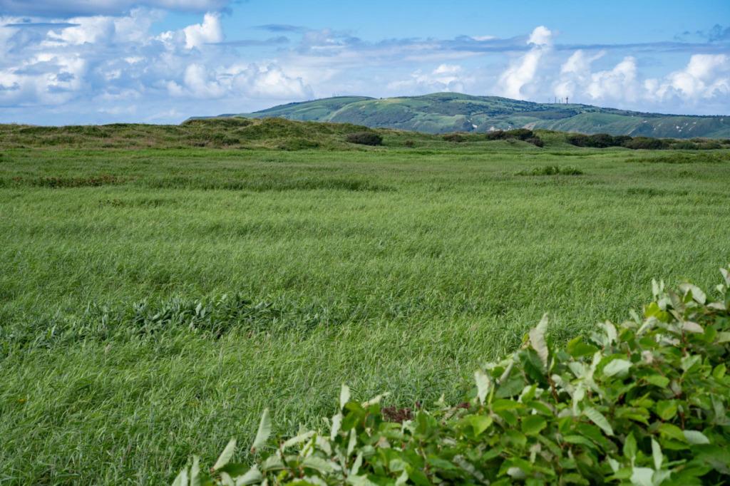
Cycling while gazing at Mt. Rishiri, which shifts the foreground from sea to grassland, is a feast for the eyes.
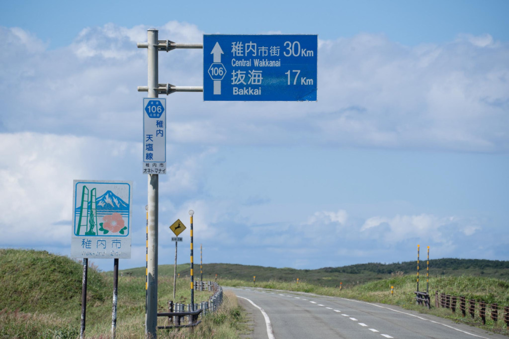
Continuing north, the roadside sign for Wakkanai—the northernmost city in Japan—finally appears. Yet the city center is still 30 km away. From here, some riders may feel, “I can still enjoy more stunning scenery,” while others may think, “I just want to reach the goal.” By the time your eyes grow accustomed to the breathtaking views, fatigue may start to take over. Still, that mix of emotions is part of the unique experience that only this road can offer.
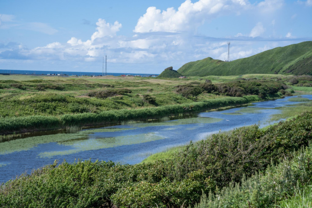
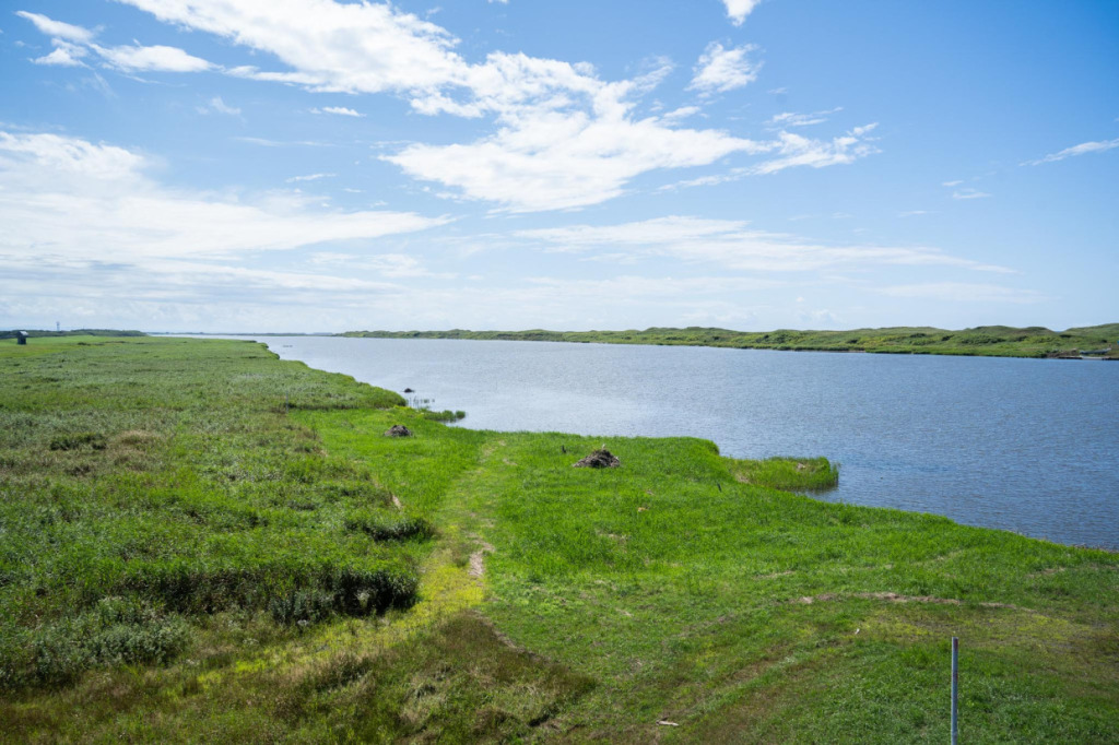
After passing the Wakkanai roadside sign, the coastal and plain landscapes that had continued so far gradually begin to change. What comes into view now are wetlands spreading along the rivers. Aquatic plants float on the water’s surface, offering a different atmosphere from the dry plains seen earlier. The appearance of this “wetland” as a third type of scenery adds a fresh dimension to the journey as you near the goal.
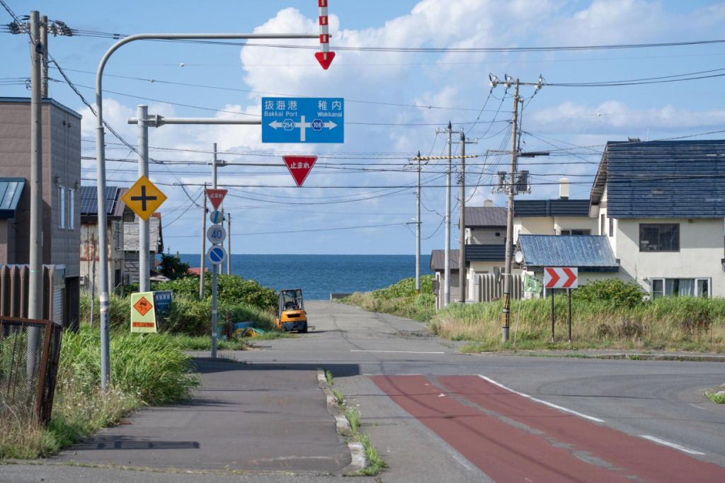
We approach the fork between Routes 106 and 254. Turning right will take you over a hill and straight into Wakkanai city, while turning left follows a flatter road for a while, making a slightly longer detour. Since there’s still plenty of time before sunset, we deliberately chose Route 254. This route passes by Cape Noshappu, allowing us to end the ride with the scenic views from the cape.
5. Cape Noshappu, a northern cape town
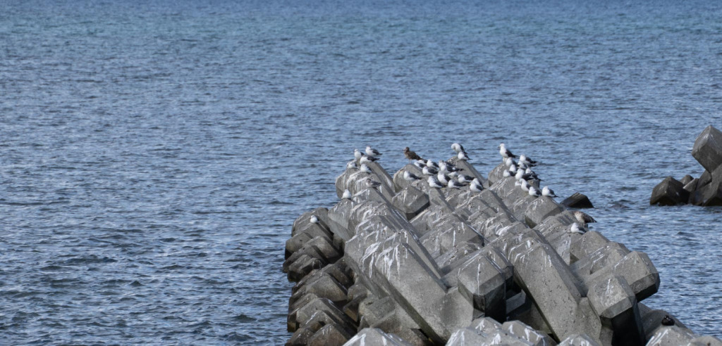
Cycling from Wakkanai city, we arrived at Cape Noshappu. The cape’s plaza features a dolphin monument and a clock tower, attracting visiting tourists. Located along the open coastline, it’s a refreshing spot where you can feel the expanse of sky and sea on clear days. Seagulls darted about everywhere, creating a scene characteristic of a northern port town.
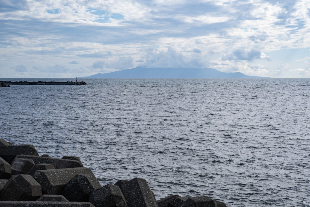
From the tip of the cape, you can of course see Rishiri Island. On this day, the summit was hidden by clouds, so the full shape of Mt. Rishiri wasn’t visible, but its massive presence was still clearly conveyed and left a strong impression.
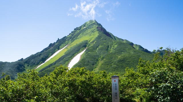
Mt. Rishiri is such a beautiful, standalone peak that it’s often called “Rishiri Fuji,” and its appearance is nothing short of spectacular. Looking back at photos I took on Rishiri Island in the past, its presence is even more striking than when viewed from Wakkanai. Even those who aren’t mountain enthusiasts will find themselves wanting to see it up close at least once.
If you make it to Wakkanai, a trip over to Rishiri Island makes for a great plan. Having been a constant presence on the horizon while riding the Ororon Line, Mt. Rishiri has likely become a familiar companion to travelers. By taking a ferry, you can enjoy a cycling tour around the base of the mountain, getting closer to the peak that has accompanied you along the way and experiencing its full grandeur—a truly fulfilling ride.
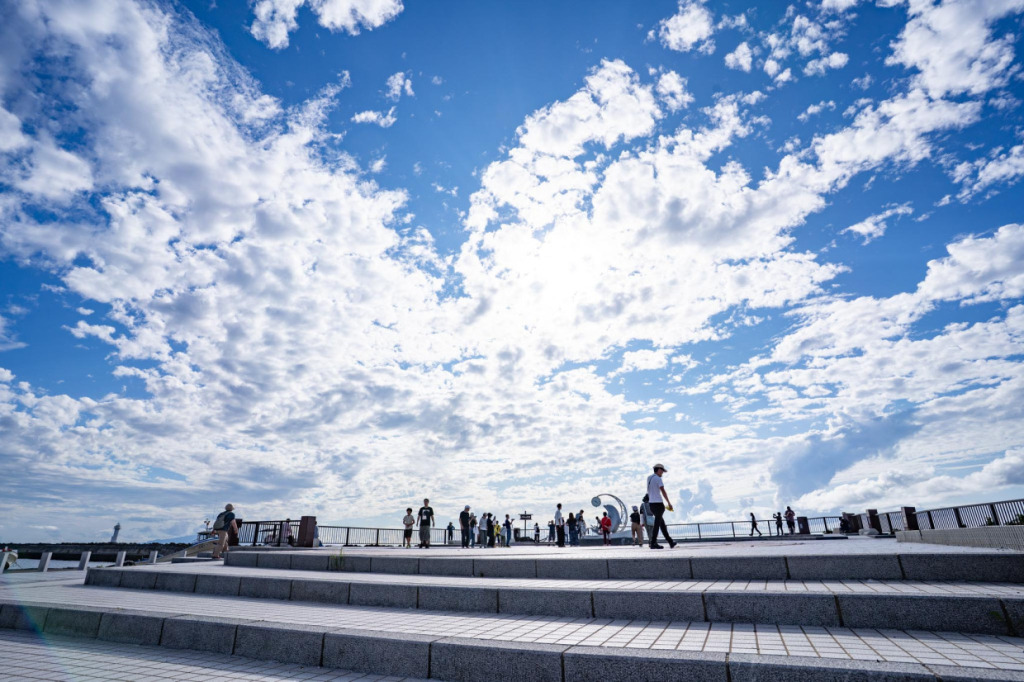
6. Wakkanai, the final destination of the Ororon Line
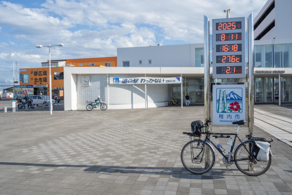
After riding a long journey, we finally arrive at Wakkanai Station. Standing in front of the sign marking Japan’s northernmost railway station, a sense of accomplishment slowly washes over you. The journey, guided by the stunning scenery of the Ororon Line, reaches a natural milestone here.
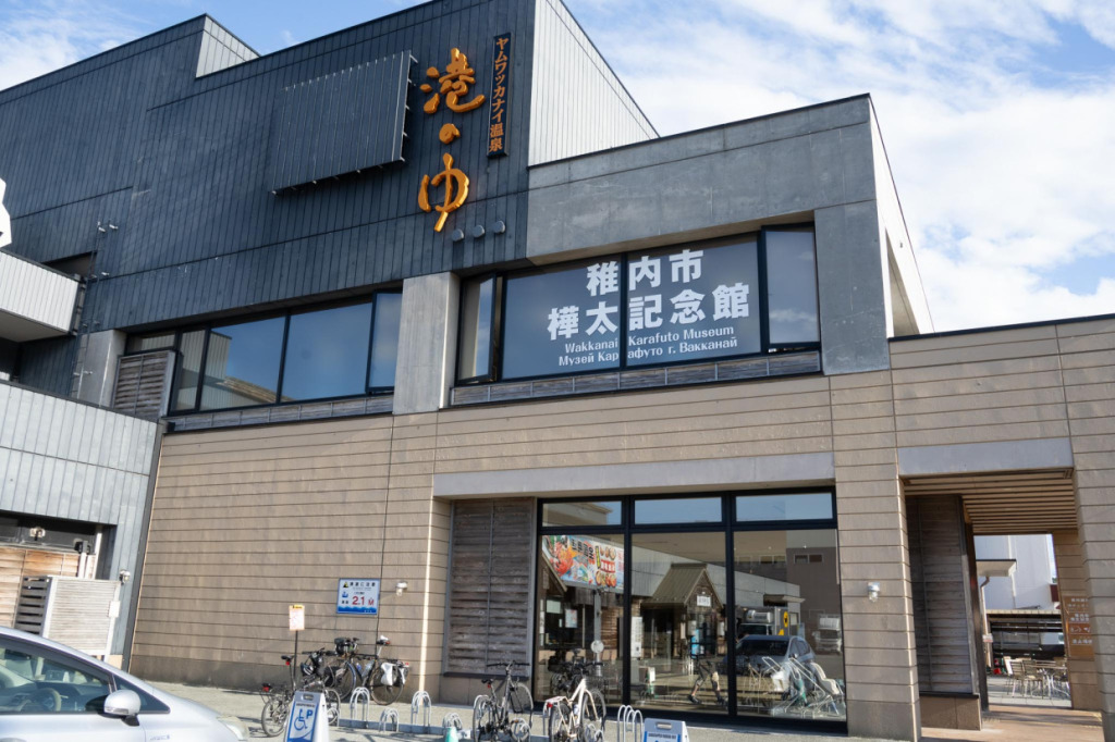
For a refreshing soak, we recommend Yam Wakkanai Onsen “Minato no Yu,” located just a short distance from the station. Immerse yourself in the spacious baths and rejuvenate your tired body. As a reward after reaching the goal, enjoying a hot spring at Japan’s northernmost point is truly special.
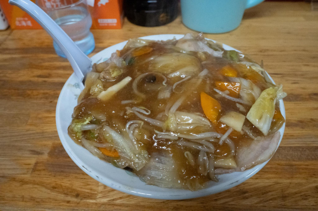
And in Wakkanai, be sure to try the city’s soul food, “Chāmen.” This dish features boiled Chinese noodles stir-fried in oil, topped with a generous amount of thick sauce filled with ingredients. Its appeal lies in the combination of chewy and crispy textures. It’s truly delicious, and one of the dishes I always make sure to eat whenever I visit Wakkanai.
This time, we followed the Ororon Line, a scenic route along the Sea of Japan, all the way to Wakkanai. The vast plains, the sea, and the views of Mt. Rishiri are full of a unique charm found only here. If you’re traveling in Hokkaido, be sure to experience the scenery of the Ororon Line at least once.
🚲Reference Websites
About the Ororon Line – Teshio Town Tourism Association
https://www.teshio-tourism.com/%E3%82%AA%E3%83%AD%E3%83%AD%E3%83%B3%E3%83%A9%E3%82%A4%E3%83%B3Wakkanai, Rishiri, Rebun – Tourism Website https://www.north-hokkaido.com/feature/detail_40.html
Yam Wakkanai Onsen “Minato no Yu” https://minatonoyu.fill-sapporo.com/
Profile
Hokokara
Originally from Miyazaki Prefecture, Hokokara is a blogger who travels across Japan with a focus on mountains and shrines. In the past, he completed a cycling journey around the entire country. Currently, through his blog Hinomoto Angya, he shares articles on mountaineering, history, and landscapes. In the future, they he plans to expand his reporting internationally, showcasing the charms of both Japan and the world.
Blog: https://fawtblog.com/