Accompanying Report: Ehime Prefecture’s Cycling FAM Tour 2025 for Overseas Media
#02
#02

The cycling journey tracing Hokusai’s Thirty-six Views of Mount Fuji reaches its grand finale. In this final chapter, we’ll visit cycling spots where you can admire South Wind, Clear Sky and Rainstorm Beneath the Summit—two of the most iconic works alongside The Great Wave off Kanagawa.
We’ll also explore Lake Suwa in Shinano Province and conclude the series with Groups of Mountain Climbers, the only work in the collection painted from within the mountain itself.
Join us as we discover the modern landscapes that echo Hokusai’s Thirty-six Views of Mount Fuji in this concluding chapter.
Top artwork: Katsushika Hokusai, “South Wind, Clear Sky”
All Hokusai images courtesy of the Tokyo Fuji Art Museum
Text & Photos by Hokokara
Table of Contents
1. Rainstorm Beneath the Summit — From the Jūrigi Highlands Observatory
2. Koshu Misaka Suimen — From Lake Kawaguchi
3. South Wind, Clear Sky — From Lake Yamanaka
4. Groups of Mountain Climbers — From Mount Fuji
5. At the End of the Journey

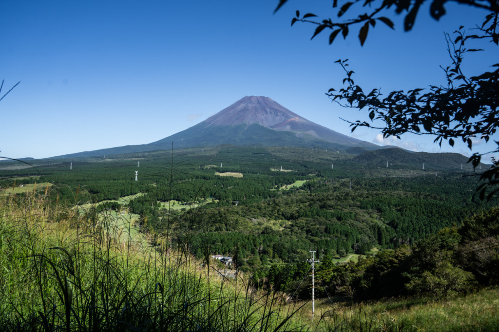
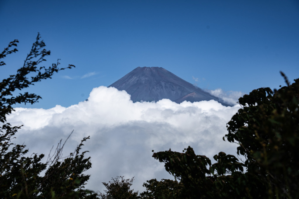
Rainstorm Beneath the Summit (Sanka-haku’u) is one of Hokusai’s three most celebrated works from Thirty-six Views of Mount Fuji, along with The Great Wave off Kanagawa and South Wind, Clear Sky. The summit appears clear and calm, while thick white clouds billow from the mountainside, and the foothills are shrouded in dark rain clouds—though they aren’t depicted as such, the black mass suggests a storm. The yellow zigzag line in the lower right of the composition represents a flash of lightning.
Despite its title, Rainstorm Beneath the Summit portrays a dark “Black Fuji,” a contrast to what one might imagine from the name. While it’s difficult to find a setting that reproduces the same atmosphere exactly, I searched for a view that came as close as possible. Incidentally, the word haku’u (白雨) means “sudden shower.”
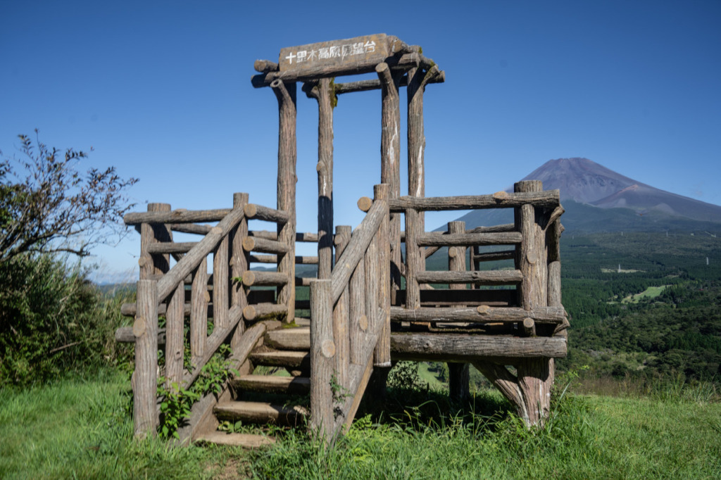
I visited the Jurigi Highlands Parking Area, located roughly halfway along National Route 469. This road connects Fuji City and Gotemba City, featuring a series of climbs and descents with varying gradients. As you ascend, Mount Fuji gradually comes into view through the trees, making it feel as though you are riding alongside the majestic mountain itself.
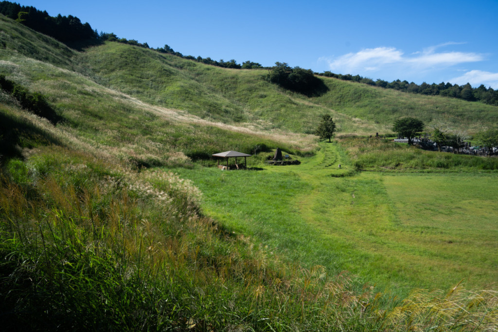
The Jurigi Highlands Parking Area serves not only as the trailhead for Mount Echizen but also as a scenic viewpoint offering a direct view of Mount Fuji. Located just about 15 kilometers from Fuji’s summit, Mount Echizen is renowned as one of the best vantage points for viewing the mountain. If your legs still have some strength left, a short climb from the parking area to the observation deck rewards you with a sweeping view of Mount Fuji in all its glory.
Here’s the view from the Jurigi Highlands Observatory. You can enjoy this breathtaking panorama after just a 15-minute climb from the parking area—no need to go all the way to the summit of Mount Echizen.
This cloudless scene was captured around 9 a.m., but after 10 a.m., as the air warms, the lower slopes of the mountain quickly become shrouded in clouds.
You can truly feel the saying, “Mountain weather changes quickly,” just by watching from here. It’s possible that it’s raining down in the foothills right now. While we couldn’t witness lightning like in Rainstorm Beneath the Summit, we were able to enjoy an impressively close view of Mount Fuji in all its power. The Jurigi Highlands Observatory is a highly recommended viewpoint.

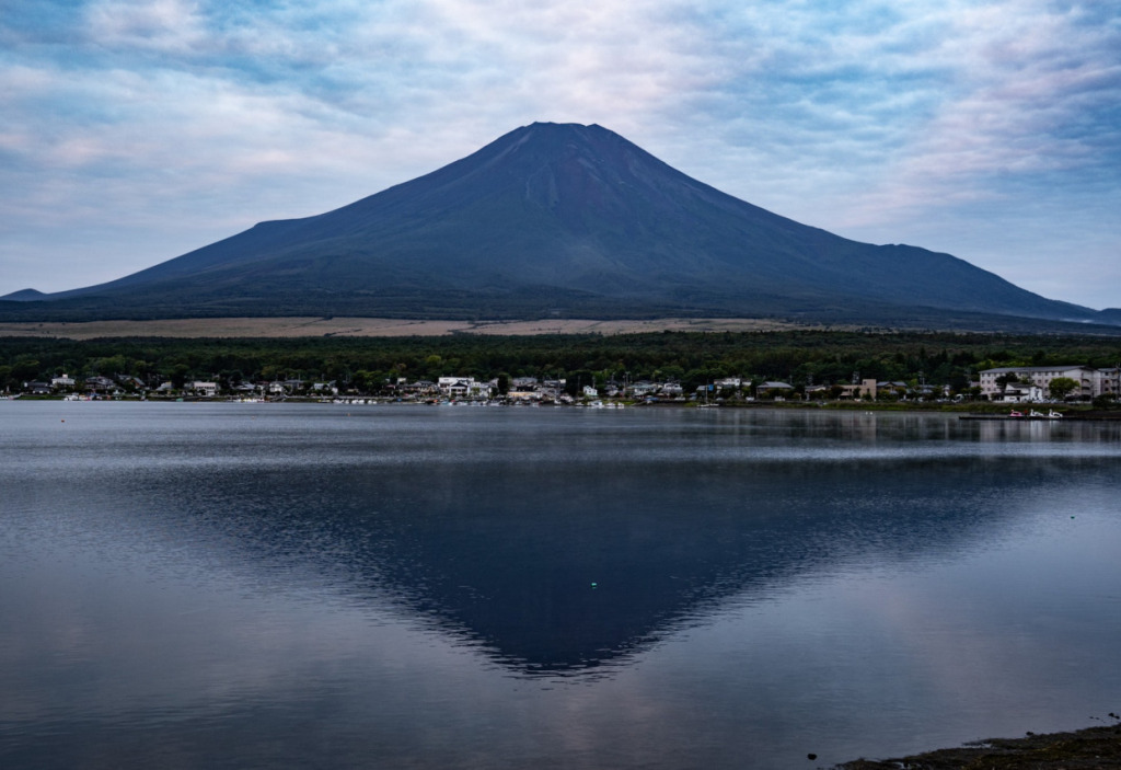
“Kōshū Misaka” refers to the Misaka Pass, which spans Fujikawaguchiko Town and Misaka Town in Yamanashi Prefecture. However, while Mount Fuji can be seen from Misaka Pass, the view of Lake Kawaguchi is not possible from there. Therefore, this print is believed to depict Mount Fuji as seen from the shores of Lake Kawaguchi.
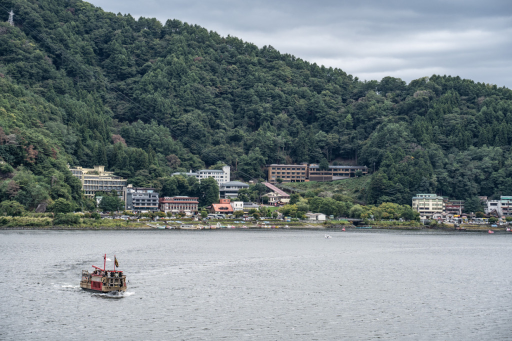
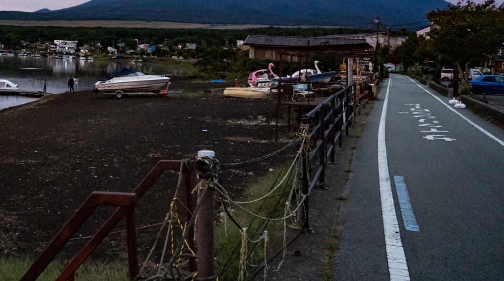
The next Thirty-six Views spot we’ll visit is Lake Kawaguchi. The lake is very accessible, located right by Kawaguchiko Station on the Fujikyu Railway line.
A blue line marking the route has been set up along the roads around the lake, making it perfect for a circular cycling tour. There are also several rental bike shops along the lakeshore, so you can enjoy cycling even if you come empty-handed.
The distance to Mount Fuji here is nearly as close as from the previously mentioned Jurigi Highlands Observatory. You can really feel the presence of the majestic mountain up close.
When I visited, unfortunately most of Fuji was hidden by clouds, so I couldn’t see the reflected “inverted Fuji” on the lake as depicted in the print. But that’s where imagination comes in—envisioning your ideal Fuji. Surely Hokusai did the same.
After all, the print Koshuumisakasuimen contains a bold artistic “lie.” The position and shape of the reflected inverted Fuji on the lake don’t match reality. While a reflection should mirror the mountain symmetrically, in the print it is shifted to the left. Additionally, the main Fuji is shown as a summer mountain, but the reflected version is snow-capped like a winter Fuji. This clever, impossible composition showcases Hokusai’s imaginative genius.
Next is the final of the “Three Roles” of the Thirty-six Views of Mount Fuji, South Wind, Clear Sky. Commonly known as “Red Fuji,” it depicts Mount Fuji in summer with its striking reddish-brown slopes. The term South Wind refers to the gentle south winds of early summer. As you may have seen in previous articles, summer mountains are often shrouded in haze or clouds, but this Red Fuji stands out so clearly—perhaps thanks to the south wind blowing them away.
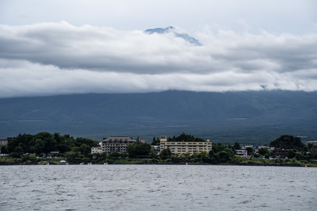
Also, as the title “South Wind, Clear Sky” makes clear, the artwork doesn’t specify a location, so there are various theories about where it was painted, but none have been confirmed. Like with Koshuumisakasuimen, I could have photographed it from Lake Kawaguchi, a famous vantage point for viewing Mount Fuji… but seeking some variety, I came to Lake Yamanaka. Like Lake Kawaguchi, Lake Yamanaka is a renowned spot for seeing the “mirrored” Fuji. Although there’s no nearby station and access isn’t exactly convenient, it’s only about 15 km from Lake Kawaguchi, which isn’t far by bike. A cycling path runs along the lakeshore, and it might even be easier to ride here than around Lake Kawaguchi.
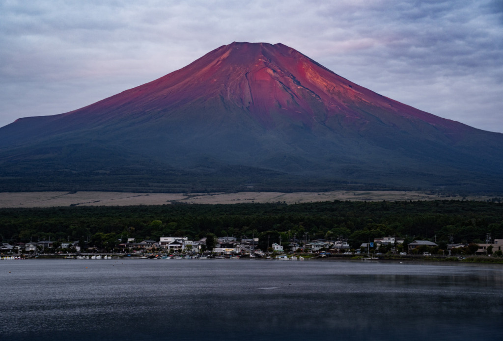
Here is Mount Fuji as seen from Lake Yamanaka. True to South Wind, Clear Sky, it displayed an even more vivid redness. The term “Red Fuji” refers to Mount Fuji glowing red in the morning sunlight—a well-known natural phenomenon in mountaineering circles called “Morgenrot.” However, in Hokusai’s time, it’s believed that this phenomenon wasn’t widely recognized, and some suggest that the “Red Fuji” in South Wind, Clear Sky simply emphasizes the reddish-brown hues of Fuji’s summer slopes.
In any case, Lake Yamanaka offers a stunning view of Mount Fuji. Even if it’s not the perfect timing for the Morgenrot, the scenery is spectacular. Cycling around Lake Yamanaka with Mount Fuji by your side comes highly recommended.

The grand finale of this journey tracing the Thirty-six Views of Mount Fuji is “Groups of Mountain Climbers” (Shonin Tozan, also referred to by several other names). Among all 46 prints in the series, this is the only one in which Mount Fuji itself is not directly depicted. Saying it is “not depicted” isn’t entirely accurate, however—this work portrays people climbing Mount Fuji from a perspective inside the mountain.
This means the model location for the print is, of course, Mount Fuji itself. Having ventured into the very heart of the mountain we’ve been observing from afar, it’s the perfect spot to conclude the journey.
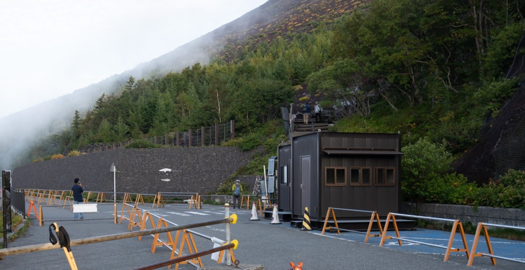
We arrived at the Fujinomiya Fifth Station parking lot, situated at an elevation of about 2,400 meters. The paved road reaching this point is a modern convenience unknown in Hokusai’s time. Thanks to it, reaching here by bicycle is possible, but there are very few tourist facilities or eateries along the way, making it a pure uphill climb. While it might serve as the setting for a race, it’s hardly a leisurely cycling route.
Moreover, to reach a viewpoint with a clear panorama from the Fifth Station parking lot, it takes about a 30-minute walk one way. It’s a light hike, but the view of Mount Fuji’s summit from the mountainside is absolutely breathtaking.
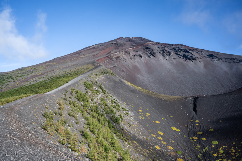
The people depicted in “Groups of Mountain Climbers” wear traditional pilgrim robes and are ordinary citizens undertaking a sacred ascent of Mount Fuji. In the first half of the 18th century, devotion to Mount Fuji spread widely among the common people, eventually giving rise to organized pilgrimage groups known as Fuji-ko. In Hokusai’s print, some climbers are shown leaning on their walking sticks, others collapsed along the path—portraits of individuals enduring what amounts to a grueling, almost ascetic, climb. It offers a glimpse into just how arduous Mount Fuji pilgrimages were at the time.
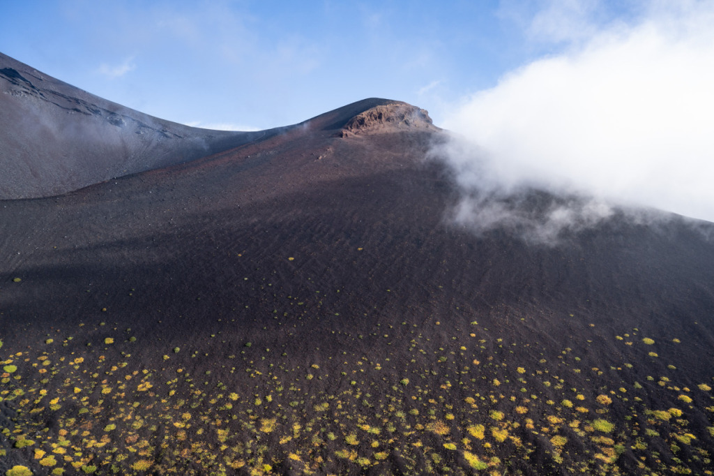
Today, paved roads reach up to the Fifth Station, and the climbing trails are well maintained. Even so, the journey to the summit is far from easy, with the elevation gain and harsh weather testing every climber. The official climbing season is limited to roughly two months, from early July to early September, but having made it this far, it’s well worth gearing up and aiming for the summit.
How was it? The three-part cycling journey tracing Hokusai’s Thirty-six Views of Mount Fuji has now come to its conclusion. By following the Fuji that Hokusai depicted and visiting these locations, we were able to experience firsthand the mountain’s unchanging presence across the ages, as well as the ever-shifting landscapes around it.
What becomes clear anew is that Mount Fuji remains an enduring symbol of Japan, captivating people even today. Visiting the places I’ve introduced may not guarantee the exact same views or impressions. Yet by overlaying the Fuji you see with the Fuji Hokusai painted, you are sure to discover insights unique to that moment—a perspective that only such a journey can provide.
If you’re seeking such an experience, why not set out on a cycling trip following the Thirty-six Views of Mount Fuji?
🚲Pedaling Through Hokusai’s Eyes
1. Shizuoka Edition
2. Chiba Edition
3. Mt.Fuji Edition
Profile
Hokokara
Originally from Miyazaki Prefecture, Hokokara is a blogger who travels across Japan with a focus on mountains and shrines. In the past, he completed a cycling journey around the entire country. Currently, through his blog Hinomoto Angya, he shares articles on mountaineering, history, and landscapes. In the future, they he plans to expand his reporting internationally, showcasing the charms of both Japan and the world.
Blog: https://fawtblog.com/
Post Date:2025.10.31