グラベルマニアが古代の旅路に乗る #01
〜紀伊山地、熊野古道、オフロード〜
〜紀伊山地、熊野古道、オフロード〜

The second installment of a cycling journey tracing the landscapes of Katsushika Hokusai’s Thirty-Six Views of Mount Fuji (in fact, forty-six works in total) by one of Japan’s most celebrated ukiyo-e artists. In the previous article, we introduced a cycling route around Fuji City in Shizuoka Prefecture, located at the very foot of Mount Fuji.
This time, our journey skips over Kanagawa and Tokyo from Shizuoka, landing in Chiba Prefecture.
The main highlight is “The Great Wave off Kanagawa,” the iconic face of “Thirty-Six Views of Mount Fuji.” To capture both the seas off Kanagawa and Mount Fuji together, the perspective must come either from above Tokyo Bay or from the Chiba side.
In this cycling trip, I’ll take you through sites in Chiba connected to Hokusai’s works — starting with “The Great Wave off Kanagawa”, followed by “At Sea off Kazusa” and “Noboto Bay”.
*The artwork at the top is Katsushika Hokusai’s “Noboto Bay.”
*The images of Katsushika Hokusai’s works featured here are sourced from The Metropolitan Museum of Art.
Text&Photo_Hokokara
Table of Contetnts
1. ”At Sea off Kazusa”
2. ”The Great Wave off Kanagawa”
3. Enjoying a feast of fried seafood
4. This is “Chiba-fornia.”
5. ”Noboto Bay”
This time, the starting point is Futtsu Park, located in Futtsu City, Chiba Prefecture. It’s about a 30-minute ride by bicycle from either Aohori Station or Onuki Station on the JR Uchibō Line. From there, we’ll pedal toward the tip of Futtsu Cape inside the park.
Even in the early hours, the scorching heat of recent days makes the sunlight feel harsh, but within Futtsu Park the shade of the black pine forest ensures a comfortable ride. The entire Futtsu Cape is maintained as a park, with well-paved roads that make cycling an absolute pleasure.
Once you reach Futtsu Park’s 3rd Parking Lot, you’re almost at the tip of the cape. For those arriving by car, this is the most convenient access point.
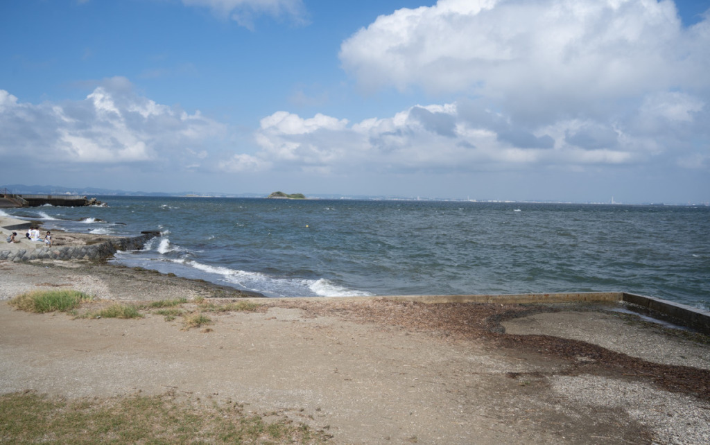
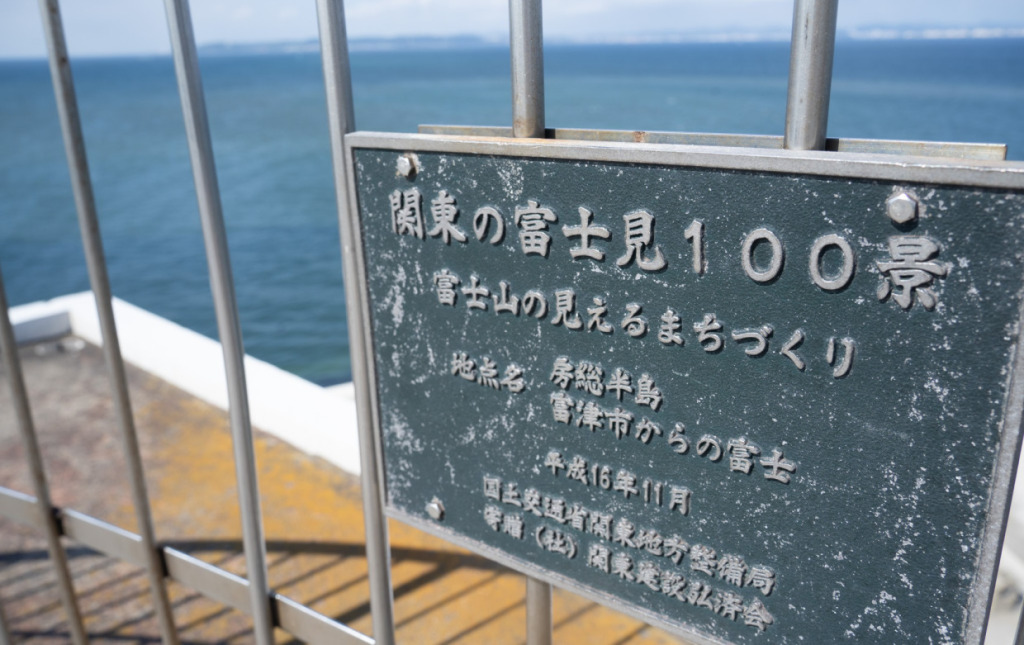
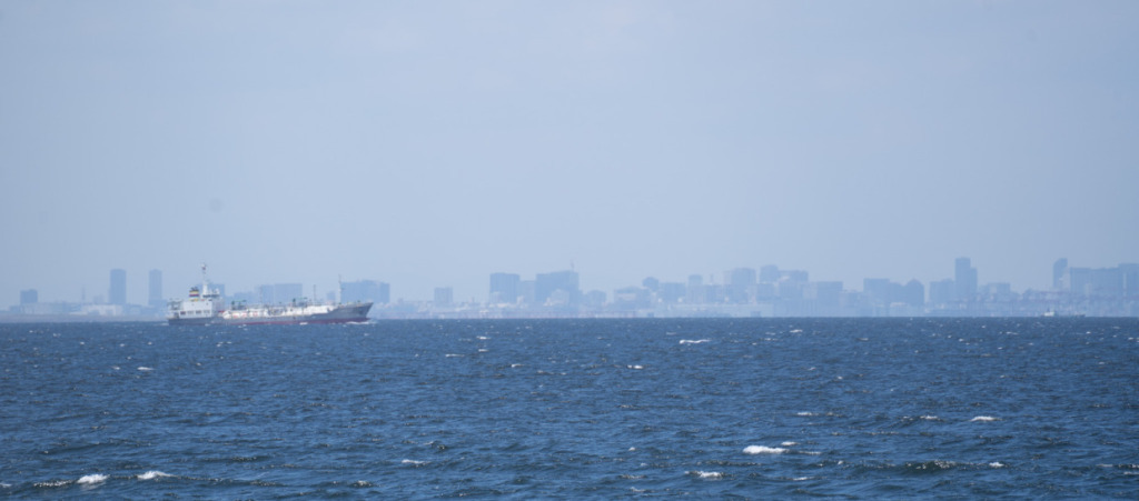
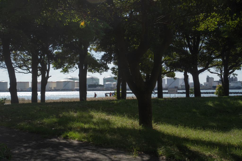
The small island-like structure standing alone in the center is the First Kaihō, an artificial island constructed from the Meiji to Taishō periods for the defense of the capital. Mount Fuji should be visible beyond this First Kaihō, but just like last time, the view of Fuji is obscured by clouds. Even when clear, it doesn’t easily reveal itself.
Still, even without Mount Fuji, the scenery is remarkable. Located near the center of Tokyo Bay, Futtsu Cape played an important role in the capital’s defense. Considering this historical context, the view of the kaihō against the sea is particularly captivating.
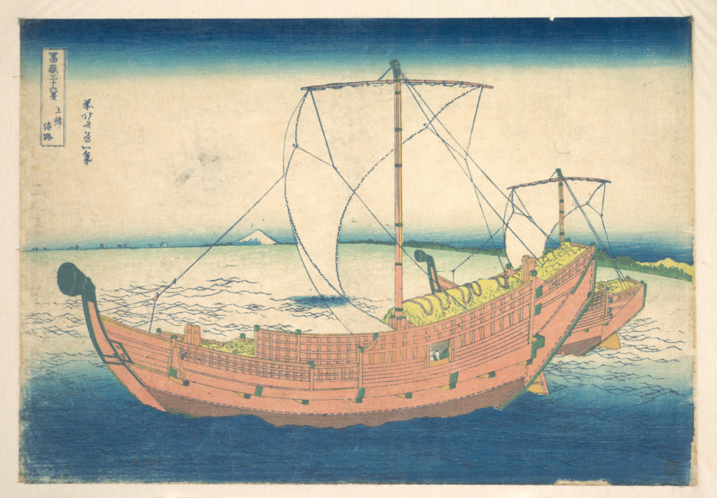
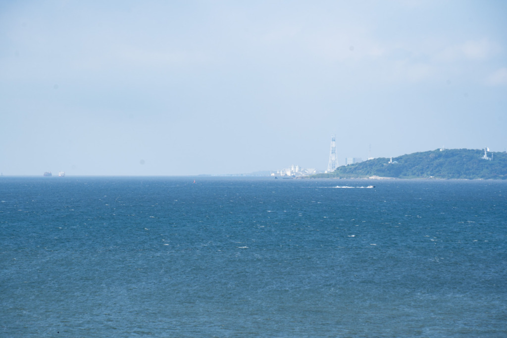
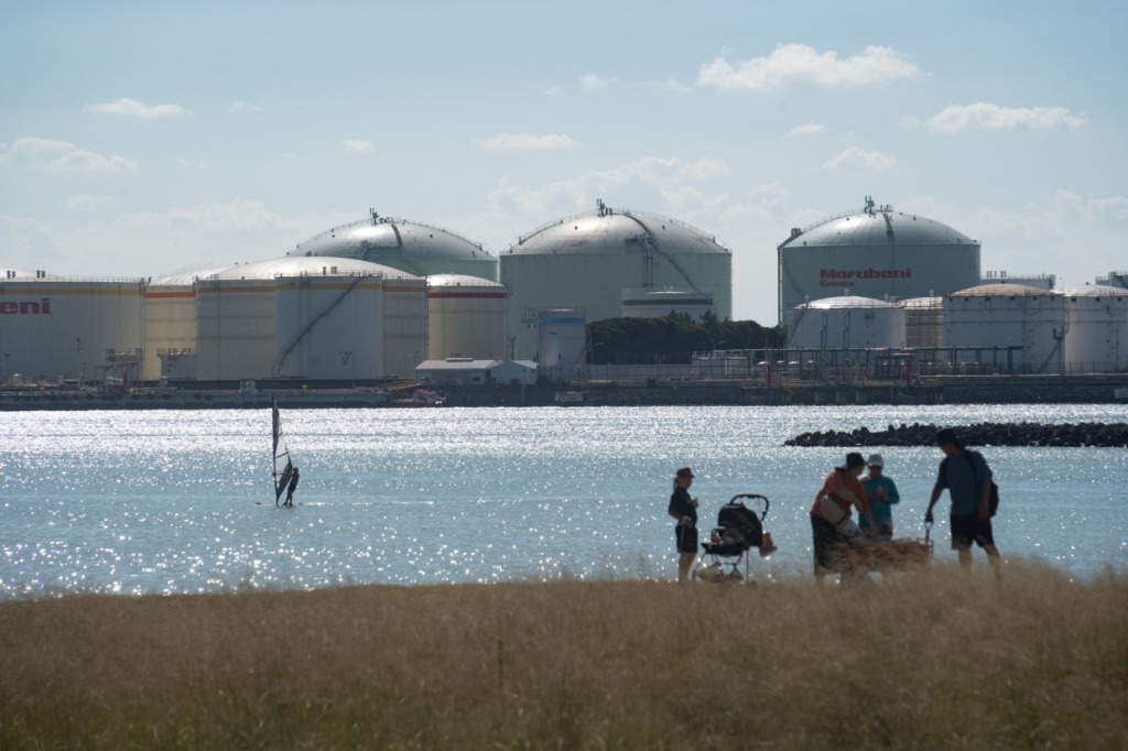
By the time you’ve reached Chiba Prefecture, the distance alone makes it impossible to expect a clear view of the full Mount Fuji, even beyond the clouds. In Hokusai’s At Sea off Kazusa, Mount Fuji is not the main subject at all—it appears only as a part of the overall landscape.
Still, that’s the brilliance of Hokusai’s composition. Framed by the sails and rigging of the large passenger and cargo ships from Kisarazu, and by the gently curved horizon forming a triangular shape, Mount Fuji inevitably draws the eye and commands a striking presence.
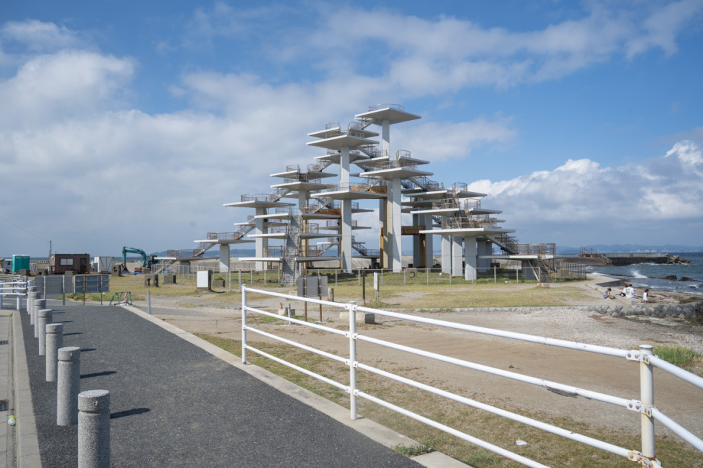
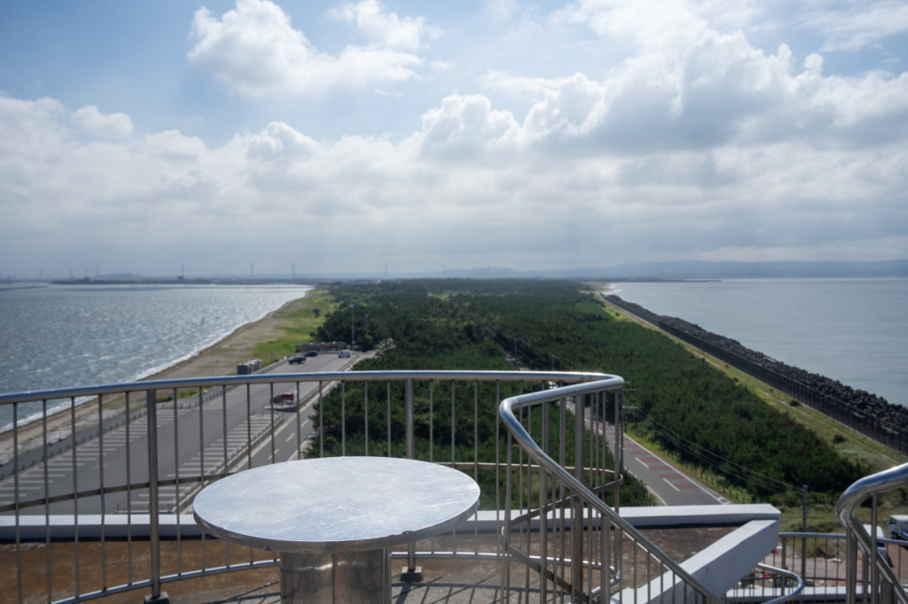
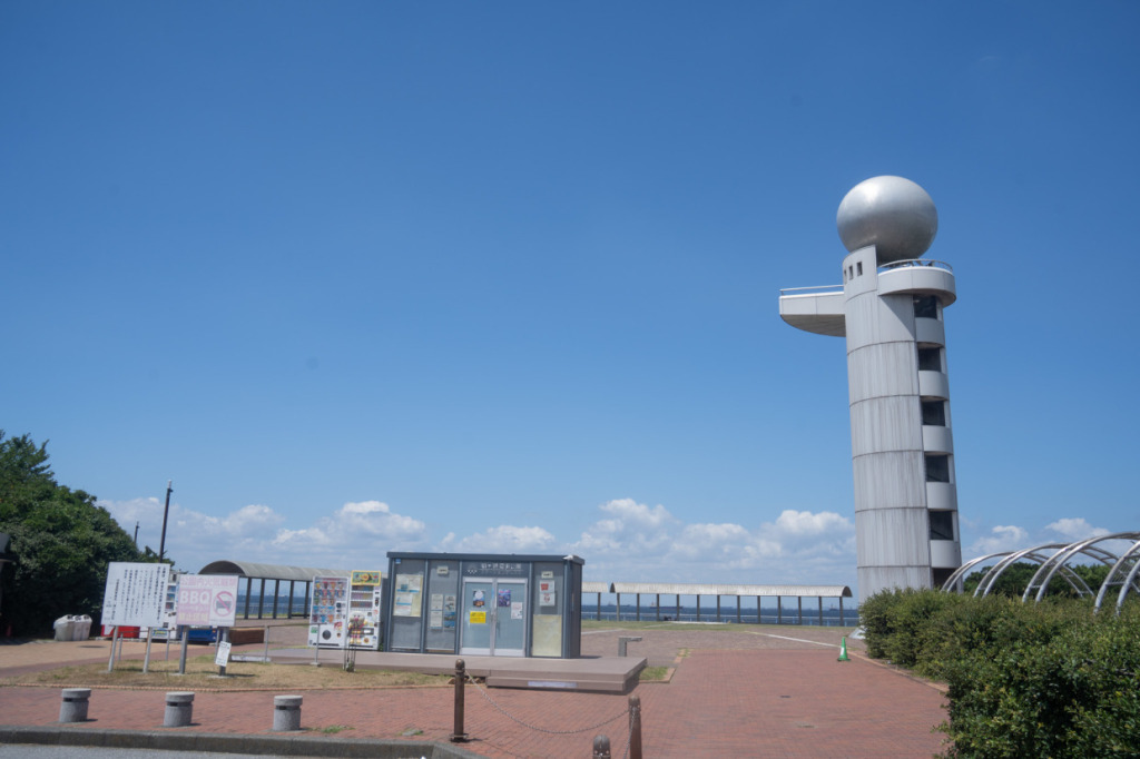
Climbing the Meiji Centennial Observation Tower, shaped like a five-needle pine, rewards you with even more spectacular views. From above, you can see Futtsu Cape and the Miura Peninsula. Being at the tip of the cape, the strong sea breeze feels especially refreshing.
Let’s also take a photo here of “The Great Wave off Kanagawa”, which is not only Hokusai’s masterpiece but also one of the most internationally recognized works in Japanese art.
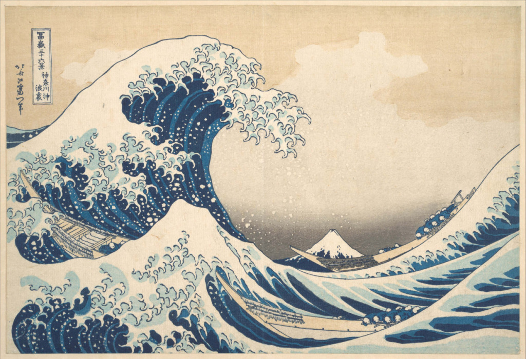
“Kanagawa off” refers to the waters off present-day Kanagawa Ward in Yokohama, near Kanagawa Port in Tokyo Bay. As the title “Wave Crest” suggests, the composition looks as if you are peering beneath the crest of a wave. The boats depicted are oshioskuri-bune, fast small vessels used to transport fresh fish to Edo. The crew can only submit before the overwhelming force of nature. This print skillfully contrasts the still, immovable Mount Fuji with the raging, dynamic waves, but…
Whether you can actually capture it like in the print is another matter. While you are positioned to view Kanagawa off, the waves are relatively calm, with only a bit of wind. If the conditions were enough to reproduce the waves of The Great Wave off Kanagawa, there would likely be evacuation orders in place.
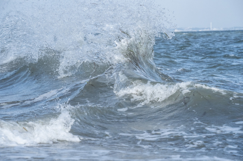
To at least capture the atmosphere, I focus on the smaller waves and press the shutter.
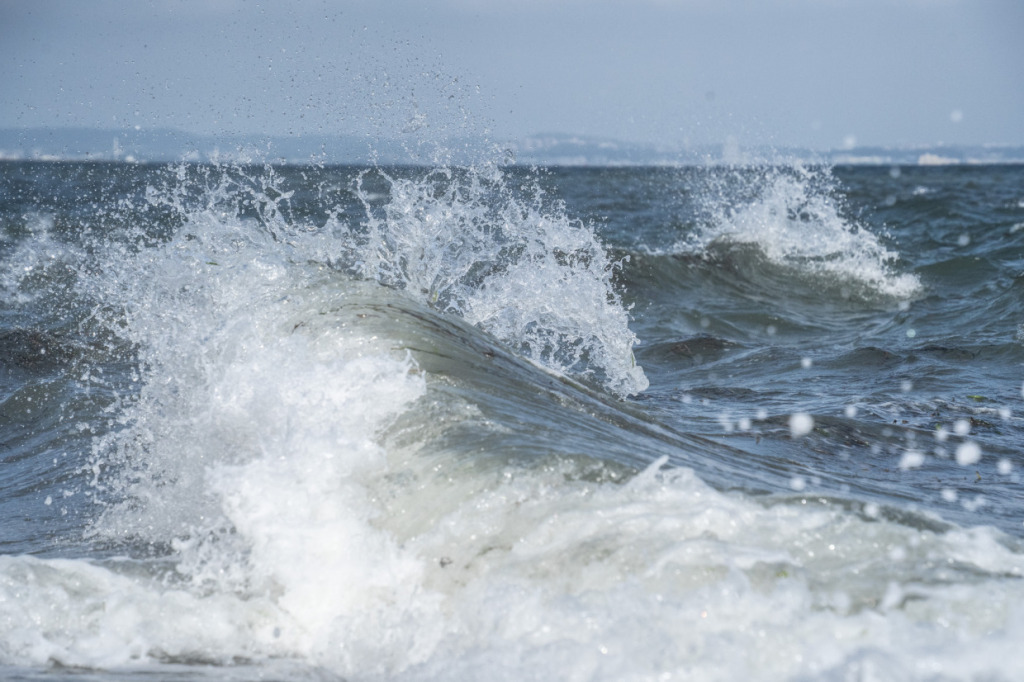
This time, I snapped the shot at a shutter speed of 1/5000 second, capturing the claw-like waves reminiscent of the print. What’s truly astonishing is Hokusai’s observational skill—he captured and painted the fleeting expressions of waves with the naked eye in an era long before single-lens reflex cameras existed.
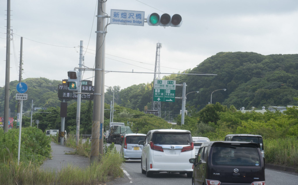
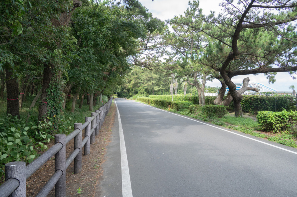
After leaving Futtsu Cape, we head north along Tokyo Bay. Route 16 is incredibly wide, making it easy to ride a bicycle comfortably. As expected in the heart of the Keiyō industrial zone stretching from Urayasu City to Futtsu City, the road’s width matches its role as a major artery for logistics.
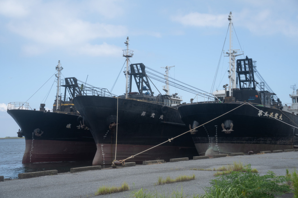
Unlike the cycling along the Suruga Bay coast last time, it’s not always possible to ride right along the shoreline here, so experiencing 100% natural scenery like the sea and greenery is more limited. However, there are plenty of striking man-made features, such as massive bridges and gut ships—work vessels used to transport construction materials like sand, gravel, and stone—offering a strong sense of Chiba as an industrial hub.
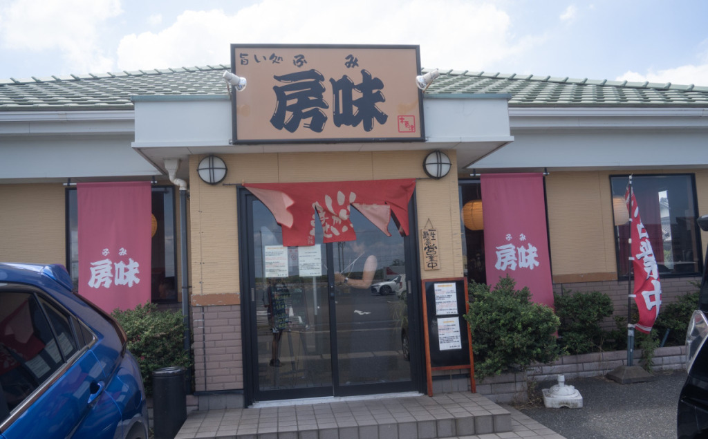
By the time I entered Kisarazu City, it was 11 a.m. A bit early, but I decided to stop for lunch here. The restaurant I visited is a local eatery called “Umai-dokoro Bōmi.” Even though it was still before the lunch rush, the parking lot was full and the place was bustling. I hadn’t done much prior research, but it was clearly a very popular spot.
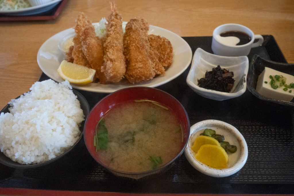
I ordered the daily Bōmi set meal, which came with chicken cutlet and fried shrimp, squid, and fish—a hearty and satisfying combination. Kisarazu is famous for seafood delicacies like grilled fish, and, by chance, I got to enjoy a meal full of the sea’s bounty.
As for the taste…
It was easy to see why the parking lot was full. A thriving restaurant like this serves simply outstanding food. I’ll definitely want to stop here again when I come back to Kisarazu. It was absolutely delicious.
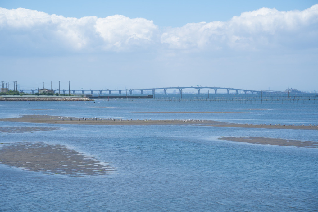
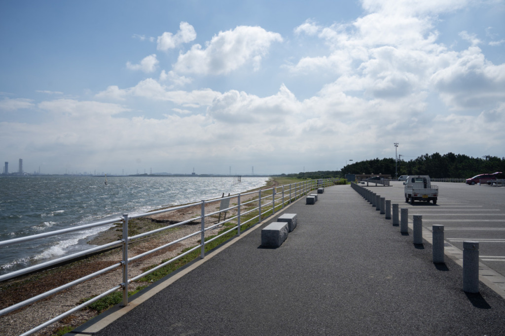
To ride along the bay, I briefly left Route 16 and continued north on Prefectural Route 87. Looking out at the sea, I noticed tidal flats had formed. This area is around Ushigome Beach, a popular clam-harvesting spot. The sea shows so many different faces here—it’s truly enjoyable.
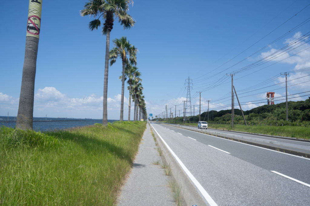
Turning onto Kaihin Park Street, you enter a straight road lined with distinctive palm trees. The scenery, reminiscent of the U.S. West Coast, has earned the area the affectionate nickname “Chiba-fornia.”
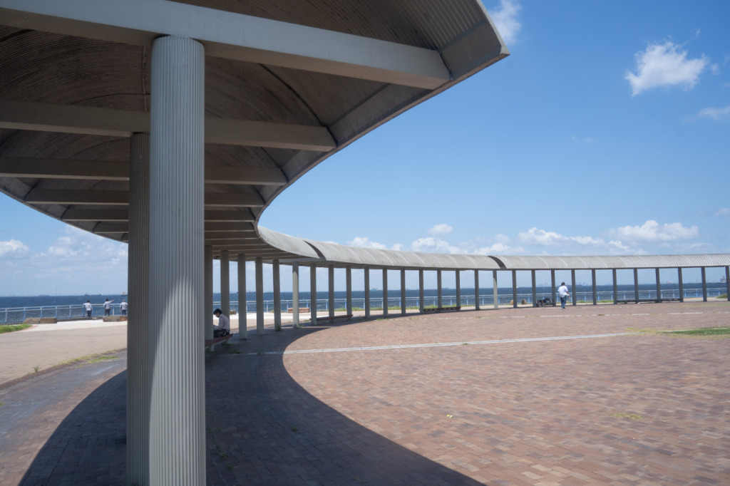
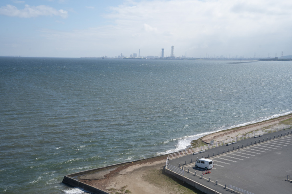
Continuing along Kaihin Park Street, we arrive at “Sodegaura Kaihin Park,” marked by a large observation tower. Given the relative positions of Mount Fuji and Kanagawa off, I chose this spot hoping it would allow me to capture a photograph resembling Hokusai’s “The Great Wave off Kanagawa”.
The views are undeniably excellent. However, with the railing in place, it wasn’t possible to get close enough to the waves for a photograph. Regardless of its connection to the Thirty-six Views, this park offers stunning scenery and is highly recommended if you have the chance to cycle along Tokyo Bay.
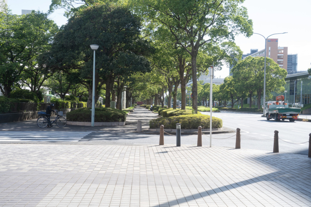
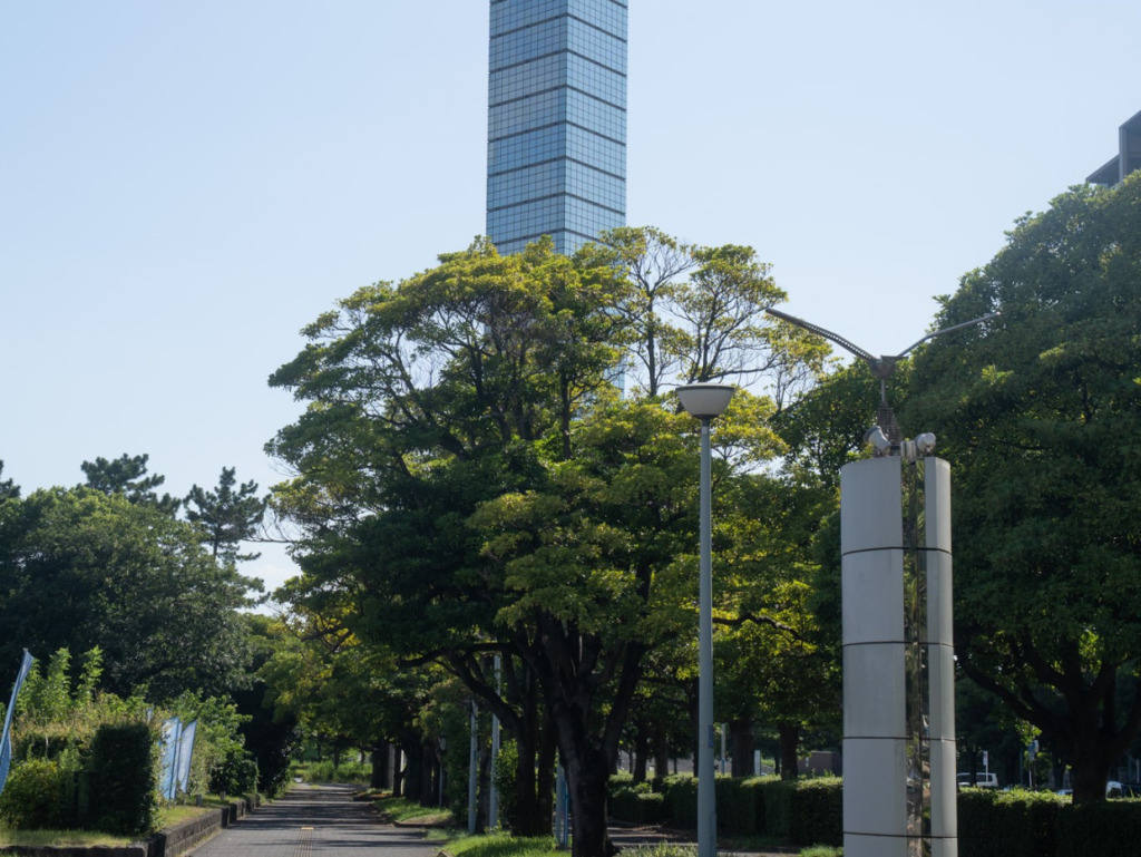
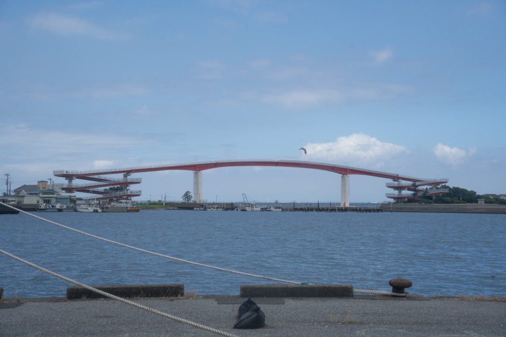
After leaving Sodegaura Kaihin Park, we head straight into the city. Passing under the street trees, we make our way to Chiba Prefecture’s iconic landmark, the Chiba Port Tower.
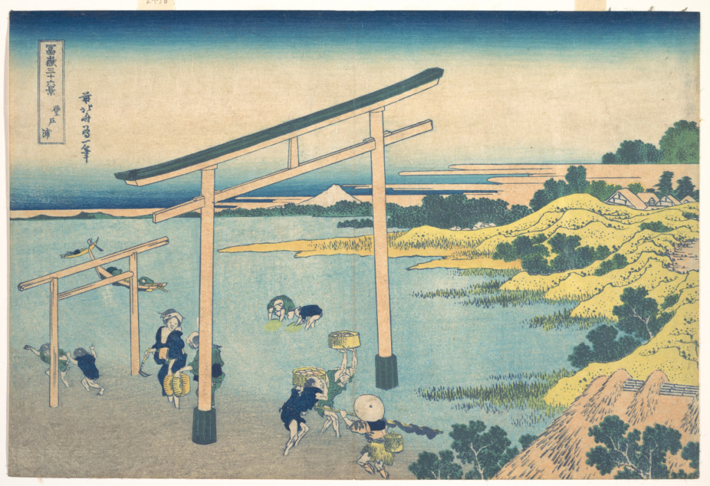
Today’s final Thirty-six Views spot is “Noboto Bay”. Noboto is now part of Chuo Ward in Chiba City, Chiba Prefecture. Although the area has been heavily reclaimed, it was once close to the coastline, much like in the print. As with the Ushigome Beach clam-harvesting area, people enjoying clamming are depicted here.
At Port Park Beach Plaza, located behind the Port Tower, you can still enjoy strolling along the sandy beach and collecting shells.
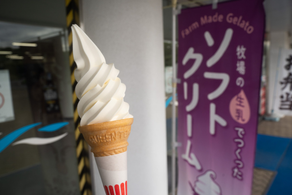
We take a short break on the first floor of the Port Tower, where you can enjoy soft serve made with 100% fresh milk from Chiba Prefecture. The cold sweetness is a perfect refreshment for a sun-warmed, tired body.
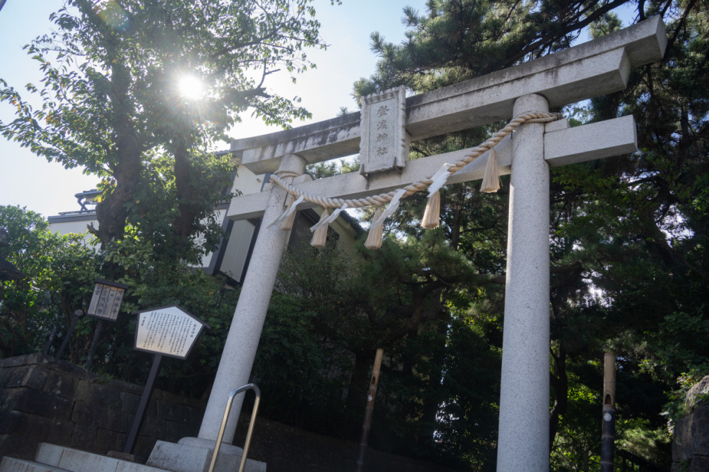
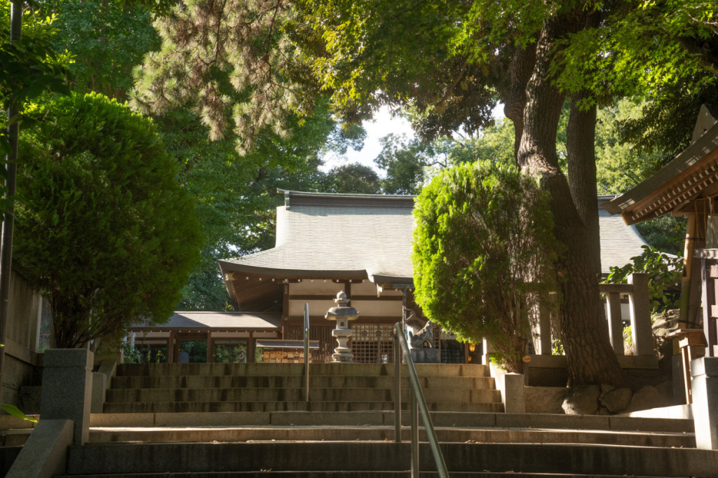
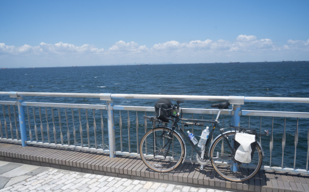
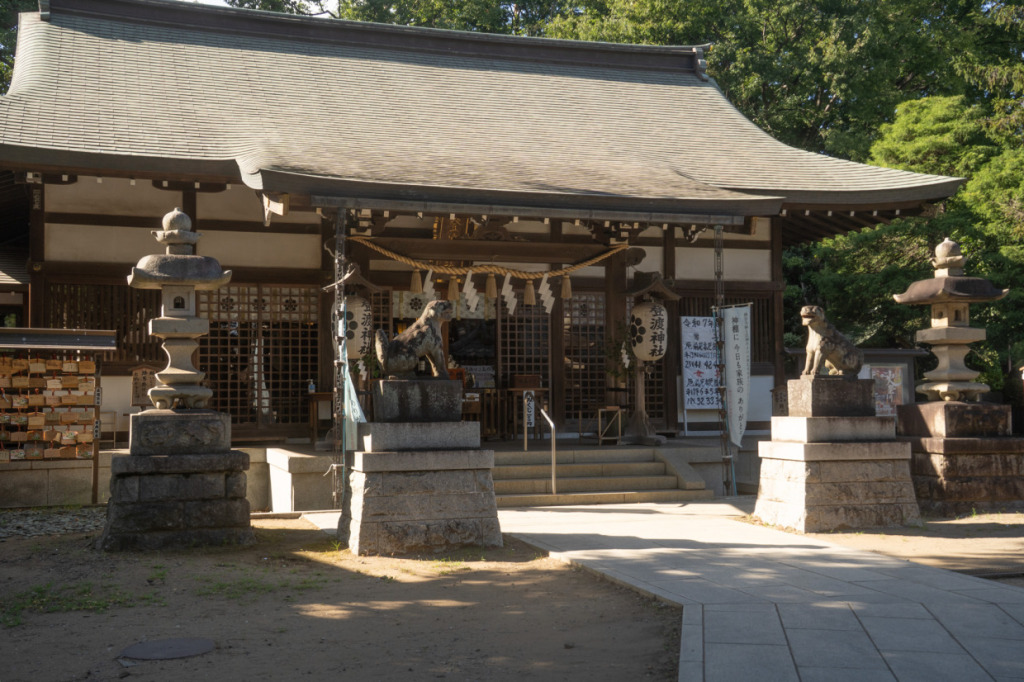
Next, we ride about 10 minutes by bike from Chiba Port Tower to Towatari Shrine. Even more eye-catching than the people clam-harvesting at Noboto Bay are the two torii gates, one large and one small. There is a theory that these gates belong to Towatari Shrine, so I came to pay a visit in person.
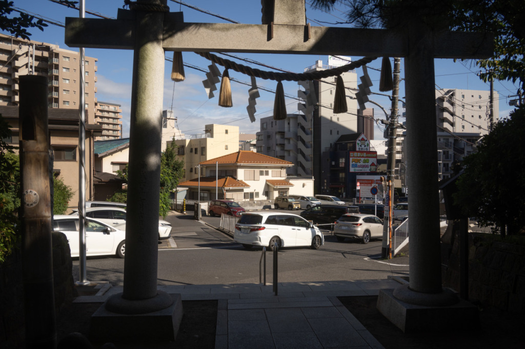
Following Noboto Bay, I took a photo from the torii, facing toward Shizuoka. There’s no trace of the submerged torii seen in the print. One theory suggests that the torii of Inage Sengen Shrine, about 4 km northwest from here, may have been the model for the Noboto Bay torii.
After leaving Towatari Shrine, we reach the finish at Chiba Station. From here, I take the train to Kimitsu Station and then ride my bike back to the starting point at Futtsu Park.
How did you enjoy this cycling journey in search of the scenes captured in Hokusai’s Thirty-six Views? The landscapes, alive with history, nature, and industry, were truly captivating. Next time, I hope to once again borrow Hokusai’s eye to share more amazing scenery with you.
🚲Reference Sites
Umaidokoro Bōmi : https://localplace.jp/t100510280/
Sodegaura Kaihin Park : https://sodegaura-kaihinpark.com/
Chiba Port Park : https://chiba-portpark.com/guide.php
Towatari Shrine : https://www.towatarijinjya.com
🚲Pedaling Through Hokusai’s Eyes
1. Shizuoka Edition
2. Chiba Edition
3. Mt.Fuji Edition
Profile
Hokokara
Originally from Miyazaki Prefecture, Hokokara is a blogger who travels across Japan with a focus on mountains and shrines. In the past, he completed a cycling journey around the entire country. Currently, through his blog Hinomoto Angya, he shares articles on mountaineering, history, and landscapes. In the future, they he plans to expand his reporting internationally, showcasing the charms of both Japan and the world.
Blog: https://fawtblog.com/
Post Date:2025.09.05